Area Overview for TQ5 0HT
Photos of TQ5 0HT
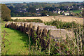
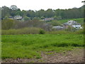
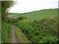
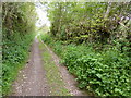
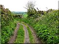
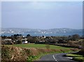
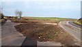
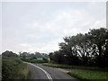


78 photos from this area
Area Information
Key information about the TQ5 0HT including its size, population, and administrative classification.
- Area Type
- Postcode
- Area Size
- 66.2 hectares
- Population
- 1243
- Population Density
- 260 people/km²
House Prices in TQ5 0HT
19
Properties
£469,600
Average Sold Price
£295,000
Lowest Price
£590,000
Highest Price
Showing 19 properties
| Address | Type | Beds | Baths | Last Sale Price | Last Sale Date | |
|---|---|---|---|---|---|---|
| The Spinney, Alston Lane, Brixham, TQ5 0HT | Semi-detached | 4 | 2 | £590,000 | Jun 2021 | |
| Alston Linhay, Alston Lane, Brixham, TQ5 0HT | Semi-detached | 4 | 3 | £427,000 | Apr 2016 | |
| Keepers Gallery, Alston Lane, Brixham, TQ5 0HT | house | 4 | - | £540,000 | Nov 2014 | |
| Old School House, Alston Lane, Brixham, TQ5 0HT | Detached | 5 | - | £496,000 | Apr 2014 | |
| Alston Farm, Alston Lane, Brixham, TQ5 0HT | Detached | - | - | £295,000 | Jan 1998 | |
| The Barnyard, Higher Alston Farm, Alston Lane, Brixham, TQ5 0HT | Semi-detached | 4 | 2 | - | - | |
| The Lodge, Alston House, Alston Lane, Brixham, TQ5 0HT | Semi-detached | 2 | 2 | - | - | |
| Schoolmasters Cottage, Alston Lane, Brixham, TQ5 0HT | Cottage | 3 | - | - | - | |
| Tennis 57M From 6 Alston Farm Cottages, Alston Lane 67M From Alston Lane, Alston Lane, Brixham, TQ5 0HT | Leisure | - | - | - | - | |
| Keepers Cottage, Alston Lane, Brixham, TQ5 0HT | Terraced | - | - | - | - |
Page 1 of 2
Energy Efficiency in TQ5 0HT
Amenities
Schools
| Rank | School | Type | Entry gender | Ages |
|---|
Explore more schools in this area
Go to Schools tabDemographics
Household Size
Two person
most common
Accommodation Type
Houses
most common
Tenure
78
majority
Ethnic Group
White
most common
Religion
N/A
most common
Household Composition
N/A
most common
Age
47
median
Elderly (65+ years)
most common
Household Deprivation
N/A
with no deprivation
NS-SEC
36
in Lower managerial occupations
Explore more demographic insights in this area
Go to Demographics tabPlanning
Planning Constraints
- Flood RiskPremium
- Ramsar Wetland SitesPremium
- Area of Outstanding Natural BeautyPremium
- Protected Nature ReservePremium
- Protected WoodlandPremium