Area Overview for TQ5 0HG
Photos of TQ5 0HG
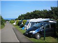
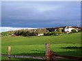
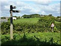
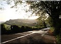
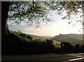
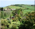

56 photos from this area
Area Information
Key information about the TQ5 0HG including its size, population, and administrative classification.
- Area Type
- Postcode
- Area Size
- 2.0 hectares
- Population
- 1094
- Population Density
- 58 people/km²
House Prices in TQ5 0HG
41
Properties
£213,092
Average Sold Price
£59,950
Lowest Price
£405,000
Highest Price
Showing 41 properties
| Address | Type | Beds | Baths | Last Sale Price | Last Sale Date | |
|---|---|---|---|---|---|---|
| 28 Hillhead Park, Hillhead, TQ5 0HG | Bungalow | 2 | 1 | £262,500 | Dec 2024 | |
| 19 Hillhead Park, Hillhead, TQ5 0HG | Bungalow | 3 | 2 | £405,000 | May 2024 | |
| 17 Hillhead Park, Hillhead, TQ5 0HG | Bungalow | 4 | 3 | £387,500 | Jan 2023 | |
| 23 Hillhead Park, Hillhead, TQ5 0HG | Bungalow | 2 | 1 | £335,000 | Aug 2022 | |
| 11 Hillhead Park, Hillhead, TQ5 0HG | Retail | 4 | 1 | £315,000 | Apr 2022 | |
| 25 Hillhead Park, Hillhead, TQ5 0HG | Bungalow | 3 | 3 | £250,000 | Jan 2021 | |
| 26 Hillhead Park, Hillhead, TQ5 0HG | Bungalow | 3 | 1 | £199,950 | Nov 2020 | |
| 33 Hillhead Park, Hillhead, TQ5 0HG | Bungalow | 2 | 1 | £270,000 | Sep 2020 | |
| 18 Hillhead Park, Hillhead, TQ5 0HG | Bungalow | 3 | 2 | £249,950 | Apr 2019 | |
| 16 Hillhead Park, Hillhead, TQ5 0HG | Detached | 4 | 3 | £322,500 | May 2018 |
Page 1 of 5
Energy Efficiency in TQ5 0HG
Amenities
Schools
| Rank | School | Type | Entry gender | Ages |
|---|
Explore more schools in this area
Go to Schools tabDemographics
Household Size
Two person
most common
Accommodation Type
Houses
most common
Tenure
82
majority
Ethnic Group
White
most common
Religion
N/A
most common
Household Composition
N/A
most common
Age
47
median
Adults (30-64 years)
most common
Household Deprivation
N/A
with no deprivation
NS-SEC
42
in Lower managerial occupations
Explore more demographic insights in this area
Go to Demographics tabPlanning
Planning Constraints
- Flood RiskPremium
- Ramsar Wetland SitesPremium
- Area of Outstanding Natural BeautyPremium
- Protected Nature ReservePremium
- Protected WoodlandPremium