Area Overview for TQ5 0AH
Photos of TQ5 0AH
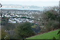
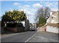
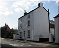
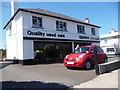
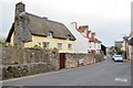
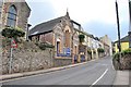
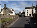
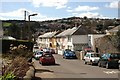
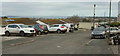
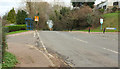
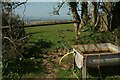
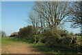
35 photos from this area
Area Information
Key information about the TQ5 0AH including its size, population, and administrative classification.
- Area Type
- Postcode
- Area Size
- 6928 m²
- Population
- 1410
- Population Density
- 2464 people/km²
House Prices in TQ5 0AH
7
Properties
£220,000
Average Sold Price
£118,000
Lowest Price
£355,000
Highest Price
Showing 7 properties
| Address | Type | Beds | Baths | Last Sale Price | Last Sale Date | |
|---|---|---|---|---|---|---|
| The Limit, Southdown Hill, Brixham, TQ5 0AH | Detached | 4 | 2 | £355,000 | May 2015 | |
| Greenacres, Southdown Hill, Brixham, TQ5 0AH | Detached | - | - | £269,000 | Oct 2004 | |
| Thatchers Mount, Southdown Hill, Brixham, TQ5 0AH | Semi-detached | - | - | £118,000 | Oct 2001 | |
| Meadowside, Southdown Hill, Brixham, TQ5 0AH | Detached | - | - | £138,000 | Oct 1999 | |
| 27 Southdown Hill, Brixham, TQ5 0AH | Bungalow | 2 | 1 | - | - | |
| Fair Skies, Southdown Hill, Brixham, TQ5 0AH | Semi-detached | 2 | 1 | - | - | |
| Rosecroft, Southdown Hill, Brixham, TQ5 0AH | Detached | - | - | - | - |
Energy Efficiency in TQ5 0AH
Amenities
Schools
| Rank | School | Type | Entry gender | Ages |
|---|
Explore more schools in this area
Go to Schools tabDemographics
Household Size
Two person
most common
Accommodation Type
Houses
most common
Tenure
81
majority
Ethnic Group
White
most common
Religion
N/A
most common
Household Composition
N/A
most common
Age
47
median
Adults (30-64 years)
most common
Household Deprivation
N/A
with no deprivation
NS-SEC
31
in Lower managerial occupations
Explore more demographic insights in this area
Go to Demographics tabPlanning
Planning Constraints
- Flood RiskPremium
- Ramsar Wetland SitesPremium
- Area of Outstanding Natural BeautyPremium
- Protected Nature ReservePremium
- Protected WoodlandPremium