Area Overview for TQ3 3LE
Photos of TQ3 3LE

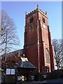
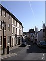
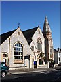
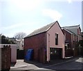
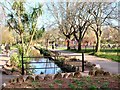
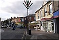
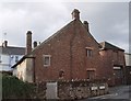
100 photos from this area
Area Information
Key information about the TQ3 3LE including its size, population, and administrative classification.
- Area Type
- Postcode
- Area Size
- 6557 m²
- Population
- 1558
- Population Density
- 4772 people/km²
House Prices in TQ3 3LE
18
Properties
£153,201
Average Sold Price
£40,000
Lowest Price
£249,950
Highest Price
Showing 18 properties
| Address | Type | Beds | Baths | Last Sale Price | Last Sale Date | |
|---|---|---|---|---|---|---|
| 16 Clifton Crescent, Paignton, TQ3 3LE | Bungalow | 2 | 1 | £146,122 | Mar 2025 | |
| 14 Clifton Crescent, Paignton, TQ3 3LE | Semi-detached | 2 | 1 | £235,000 | Sep 2021 | |
| 1 Clifton Crescent, Paignton, TQ3 3LE | Bungalow | 2 | 2 | £249,950 | Jun 2020 | |
| 13 Clifton Crescent, Paignton, TQ3 3LE | Semi-detached | 2 | 1 | £195,000 | Feb 2020 | |
| 12 Clifton Crescent, Paignton, TQ3 3LE | Semi-detached | 2 | 1 | £192,950 | Jan 2020 | |
| 10 Clifton Crescent, Paignton, TQ3 3LE | Semi-detached | 3 | 1 | £186,000 | Dec 2017 | |
| 7 Clifton Crescent, Paignton, TQ3 3LE | Bungalow | 2 | 1 | £160,000 | Sep 2016 | |
| 8 Clifton Crescent, Paignton, TQ3 3LE | Bungalow | 3 | - | £183,000 | Oct 2014 | |
| 2 Clifton Crescent, Paignton, TQ3 3LE | Bungalow | 2 | 1 | £160,000 | Jun 2014 | |
| 4 Clifton Crescent, Paignton, TQ3 3LE | Bungalow | 2 | - | £170,000 | Jul 2013 |
Page 1 of 2
Energy Efficiency in TQ3 3LE
Amenities
Schools
| Rank | School | Type | Entry gender | Ages |
|---|
Explore more schools in this area
Go to Schools tabDemographics
Household Size
Two person
most common
Accommodation Type
Houses
most common
Tenure
71
majority
Ethnic Group
White
most common
Religion
N/A
most common
Household Composition
N/A
most common
Age
47
median
Adults (30-64 years)
most common
Household Deprivation
N/A
with no deprivation
NS-SEC
21
in Lower managerial occupations
Explore more demographic insights in this area
Go to Demographics tabPlanning
Planning Constraints
- Flood RiskPremium
- Ramsar Wetland SitesPremium
- Area of Outstanding Natural BeautyPremium
- Protected Nature ReservePremium
- Protected WoodlandPremium