Area Overview for TQ3 3FR
Photos of TQ3 3FR
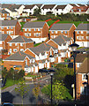
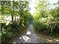
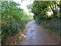
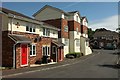
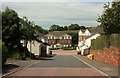
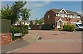
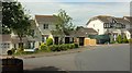

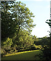


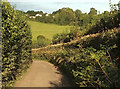
48 photos from this area
Area Information
Key information about the TQ3 3FR including its size, population, and administrative classification.
- Area Type
- Postcode
- Area Size
- 8560 m²
- Population
- 2001
- Population Density
- 399 people/km²
House Prices in TQ3 3FR
27
Properties
£239,635
Average Sold Price
£199,995
Lowest Price
£335,000
Highest Price
Showing 27 properties
| Address | Type | Beds | Baths | Last Sale Price | Last Sale Date | |
|---|---|---|---|---|---|---|
| 4 Alfriston Road, Paignton, TQ3 3FR | Detached | 3 | 2 | £235,000 | Dec 2024 | |
| 14 Alfriston Road, Paignton, TQ3 3FR | Retail | 2 | 1 | £240,000 | Jun 2022 | |
| 1 Alfriston Road, Paignton, TQ3 3FR | Detached | 4 | 2 | £335,000 | May 2022 | |
| 21 Alfriston Road, Paignton, TQ3 3FR | house | - | - | £297,950 | Feb 2021 | |
| 2 Alfriston Road, Paignton, TQ3 3FR | Detached | - | - | £299,995 | Dec 2019 | |
| 17 Alfriston Road, Paignton, TQ3 3FR | Detached | 3 | 1 | £249,000 | Jan 2019 | |
| 22 Alfriston Road, Paignton, TQ3 3FR | house | - | - | £234,995 | Dec 2018 | |
| 24 Alfriston Road, Paignton, TQ3 3FR | house | - | - | £234,995 | Dec 2018 | |
| 20 Alfriston Road, Paignton, TQ3 3FR | house | - | - | £254,995 | Dec 2018 | |
| 23 Alfriston Road, Paignton, TQ3 3FR | Detached | 3 | 2 | £244,995 | May 2018 |
Page 1 of 3
Energy Efficiency in TQ3 3FR
Amenities
Schools
| Rank | School | Type | Entry gender | Ages |
|---|
Explore more schools in this area
Go to Schools tabDemographics
Household Size
Two person
most common
Accommodation Type
Houses
most common
Tenure
75
majority
Ethnic Group
White
most common
Religion
N/A
most common
Household Composition
N/A
most common
Age
47
median
Adults (30-64 years)
most common
Household Deprivation
N/A
with no deprivation
NS-SEC
26
in Lower managerial occupations
Explore more demographic insights in this area
Go to Demographics tabPlanning
Planning Constraints
- Flood RiskPremium
- Ramsar Wetland SitesPremium
- Area of Outstanding Natural BeautyPremium
- Protected Nature ReservePremium
- Protected WoodlandPremium