Area Overview for TQ3 2BY
Photos of TQ3 2BY
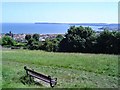

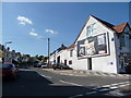
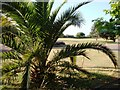
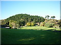
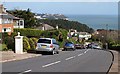
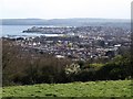
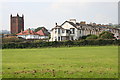
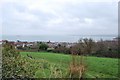
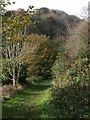
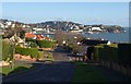
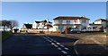
100 photos from this area
Area Information
Key information about the TQ3 2BY including its size, population, and administrative classification.
- Area Type
- Postcode
- Area Size
- 8144 m²
- Population
- 1559
- Population Density
- 5671 people/km²
House Prices in TQ3 2BY
32
Properties
£206,468
Average Sold Price
£39,950
Lowest Price
£420,000
Highest Price
Showing 32 properties
| Address | Type | Beds | Baths | Last Sale Price | Last Sale Date | |
|---|---|---|---|---|---|---|
| Ground Floor Flat, 30 Fortescue Road, Preston, Paignton, TQ3 2BY | Flat | - | - | £420,000 | Jul 2024 | |
| 30 Fortescue Road, Preston, Paignton, TQ3 2BY | house | - | - | £420,000 | Jul 2024 | |
| 31 Fortescue Road, Preston, Paignton, TQ3 2BY | house | - | - | £350,000 | Nov 2022 | |
| 25 Fortescue Road, Preston, Paignton, TQ3 2BY | Semi-detached | 4 | 2 | £390,000 | Mar 2021 | |
| 32 Fortescue Road, Preston, Paignton, TQ3 2BY | Semi-detached | 4 | 1 | £355,000 | Nov 2018 | |
| 21A Fortescue Road, Preston, Paignton, TQ3 2BY | Flat | - | - | £123,000 | Nov 2017 | |
| 20 Fortescue Road, Preston, Paignton, TQ3 2BY | house | - | - | £315,000 | Feb 2016 | |
| 36 Fortescue Road, Preston, Paignton, TQ3 2BY | Detached | 3 | 1 | £230,000 | Jan 2016 | |
| 18 Fortescue Road, Preston, Paignton, TQ3 2BY | house | - | - | £70,000 | Jul 2015 | |
| 22 Fortescue Road, Preston, Paignton, TQ3 2BY | house | 4 | - | £225,000 | Feb 2015 |
Page 1 of 4
Energy Efficiency in TQ3 2BY
Amenities
Schools
| Rank | School | Type | Entry gender | Ages |
|---|
Explore more schools in this area
Go to Schools tabDemographics
Household Size
One person
most common
Accommodation Type
Flats
most common
Tenure
63
majority
Ethnic Group
White
most common
Religion
N/A
most common
Household Composition
N/A
most common
Age
47
median
Adults (30-64 years)
most common
Household Deprivation
N/A
with no deprivation
NS-SEC
24
in Lower managerial occupations
Explore more demographic insights in this area
Go to Demographics tabPlanning
Planning Constraints
- Flood RiskPremium
- Ramsar Wetland SitesPremium
- Area of Outstanding Natural BeautyPremium
- Protected Nature ReservePremium
- Protected WoodlandPremium