Area Overview for TQ3 1BR
Photos of TQ3 1BR
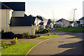
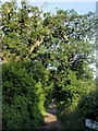
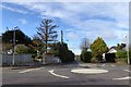
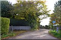
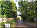
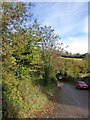
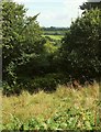
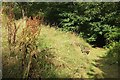
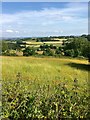
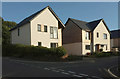

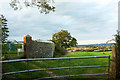
49 photos from this area
Area Information
Key information about the TQ3 1BR including its size, population, and administrative classification.
- Area Type
- Postcode
- Area Size
- 3.0 hectares
- Population
- 2303
- Population Density
- 271 people/km²
House Prices in TQ3 1BR
38
Properties
£407,533
Average Sold Price
£314,950
Lowest Price
£515,500
Highest Price
Showing 38 properties
| Address | Type | Beds | Baths | Last Sale Price | Last Sale Date | |
|---|---|---|---|---|---|---|
| 25 Moorview Crescent, Marldon, TQ3 1BR | Detached | 3 | 2 | £415,000 | Jul 2024 | |
| 18 Moorview Crescent, Marldon, TQ3 1BR | Detached | 3 | 2 | £385,000 | Mar 2024 | |
| 20 Moorview Crescent, Marldon, TQ3 1BR | house | - | - | £515,500 | Aug 2021 | |
| 26 Moorview Crescent, Marldon, TQ3 1BR | house | - | - | £380,000 | Aug 2021 | |
| 30 Moorview Crescent, Marldon, TQ3 1BR | Detached | 4 | 2 | £440,000 | Sep 2019 | |
| 27 Moorview Crescent, Marldon, TQ3 1BR | Detached | 4 | - | £425,000 | Feb 2019 | |
| 31 Moorview Crescent, Marldon, TQ3 1BR | Detached | 4 | 3 | £475,000 | Aug 2018 | |
| 1A Moorview Crescent, Marldon, TQ3 1BR | house | - | - | £329,950 | Feb 2018 | |
| 33 Moorview Crescent, Marldon, TQ3 1BR | Detached | 5 | 3 | £474,950 | Dec 2017 | |
| 28 Moorview Crescent, Marldon, TQ3 1BR | house | - | - | £494,950 | Dec 2017 |
Page 1 of 4
Energy Efficiency in TQ3 1BR
Amenities
Schools
| Rank | School | Type | Entry gender | Ages |
|---|
Explore more schools in this area
Go to Schools tabDemographics
Household Size
Two person
most common
Accommodation Type
Houses
most common
Tenure
84
majority
Ethnic Group
White
most common
Religion
N/A
most common
Household Composition
N/A
most common
Age
47
median
Adults (30-64 years)
most common
Household Deprivation
N/A
with no deprivation
NS-SEC
39
in Lower managerial occupations
Explore more demographic insights in this area
Go to Demographics tabPlanning
Planning Constraints
- Flood RiskPremium
- Ramsar Wetland SitesPremium
- Area of Outstanding Natural BeautyPremium
- Protected Nature ReservePremium
- Protected WoodlandPremium