Area Overview for TQ2 7RJ
Photos of TQ2 7RJ
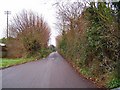
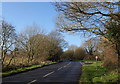
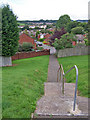
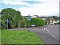
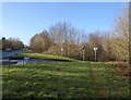
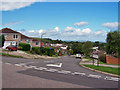
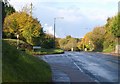
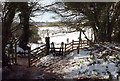
100 photos from this area
Area Information
Key information about the TQ2 7RJ including its size, population, and administrative classification.
- Area Type
- Postcode
- Area Size
- 8272 m²
- Population
- 1511
- Population Density
- 1424 people/km²
House Prices in TQ2 7RJ
29
Properties
£127,974
Average Sold Price
£39,000
Lowest Price
£245,000
Highest Price
Showing 29 properties
| Address | Type | Beds | Baths | Last Sale Price | Last Sale Date | |
|---|---|---|---|---|---|---|
| 67 Fowey Avenue, Torquay, TQ2 7RJ | Terraced | 2 | 1 | £195,000 | Nov 2025 | |
| 46 Fowey Avenue, Torquay, TQ2 7RJ | Terraced | 2 | 2 | £245,000 | Jul 2022 | |
| 58 Fowey Avenue, Torquay, TQ2 7RJ | house | - | - | £245,000 | Jun 2022 | |
| 63 Fowey Avenue, Torquay, TQ2 7RJ | Semi-detached | 3 | 1 | £170,000 | Jun 2018 | |
| 62 Fowey Avenue, Torquay, TQ2 7RJ | Terraced | 3 | 1 | £171,000 | Apr 2018 | |
| 60 Fowey Avenue, Torquay, TQ2 7RJ | house | 3 | - | £185,000 | Apr 2018 | |
| 55 Fowey Avenue, Torquay, TQ2 7RJ | Terraced | 3 | 1 | £163,000 | Nov 2015 | |
| 70 Fowey Avenue, Torquay, TQ2 7RJ | Terraced | 3 | 1 | £175,500 | May 2014 | |
| 61 Fowey Avenue, Torquay, TQ2 7RJ | house | - | - | £165,000 | Oct 2011 | |
| 57 Fowey Avenue, Torquay, TQ2 7RJ | Terraced | 3 | - | £133,000 | Aug 2009 |
Page 1 of 3
Energy Efficiency in TQ2 7RJ
Amenities
Schools
| Rank | School | Type | Entry gender | Ages |
|---|
Explore more schools in this area
Go to Schools tabDemographics
Household Size
Two person
most common
Accommodation Type
Houses
most common
Tenure
71
majority
Ethnic Group
White
most common
Religion
N/A
most common
Household Composition
N/A
most common
Age
47
median
Adults (30-64 years)
most common
Household Deprivation
N/A
with no deprivation
NS-SEC
28
in Lower managerial occupations
Explore more demographic insights in this area
Go to Demographics tabPlanning
Planning Constraints
- Flood RiskPremium
- Ramsar Wetland SitesPremium
- Area of Outstanding Natural BeautyPremium
- Protected Nature ReservePremium
- Protected WoodlandPremium