Area Overview for TQ2 6JE
Photos of TQ2 6JE
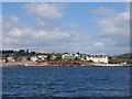
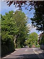
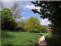
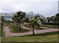


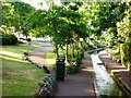
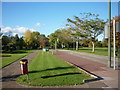

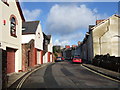

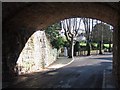
100 photos from this area
Area Information
Key information about the TQ2 6JE including its size, population, and administrative classification.
- Area Type
- Postcode
- Area Size
- 3.2 hectares
- Population
- 1514
- Population Density
- 2548 people/km²
House Prices in TQ2 6JE
44
Properties
£680,125
Average Sold Price
£227,500
Lowest Price
£1,225,000
Highest Price
Showing 44 properties
| Address | Type | Beds | Baths | Last Sale Price | Last Sale Date | |
|---|---|---|---|---|---|---|
| St Omer Care Home, Greenway Road, Chelston, Torquay, TQ2 6JE | hospital_care_home | - | - | £900,000 | Mar 2024 | |
| Burwood, Greenway Road, Chelston, Torquay, TQ2 6JE | house | 7 | 7 | £1,225,000 | Mar 2023 | |
| Woodland, Greenway Road, Chelston, Torquay, TQ2 6JE | Detached | 4 | 1 | £810,000 | Jun 2021 | |
| Upper Kismet, Greenway Road, Chelston, Torquay, TQ2 6JE | Flat | 2 | 1 | £227,500 | May 2021 | |
| Blue Waters, Greenway Road, Chelston, Torquay, TQ2 6JE | house | - | - | £753,500 | Jul 2019 | |
| Hartwell House, Greenway Road, Chelston, Torquay, TQ2 6JE | Detached | 3 | - | £590,000 | Mar 2015 | |
| Elsinore Villa, Greenway Road, Chelston, Torquay, TQ2 6JE | Bungalow | 2 | 1 | £375,000 | Jun 2013 | |
| Tresillian, Greenway Road, Chelston, Torquay, TQ2 6JE | Semi-detached | - | - | £560,000 | Jul 2003 | |
| Flat 2, Summerdyne, Greenway Road, Chelston, Torquay, TQ2 6JE | Flat | 2 | 1 | - | - | |
| Flat 8, Summerdyne, Greenway Road, Chelston, Torquay, TQ2 6JE | Flat | 3 | 2 | - | - |
Page 1 of 5
Energy Efficiency in TQ2 6JE
Amenities
Schools
| Rank | School | Type | Entry gender | Ages |
|---|
Explore more schools in this area
Go to Schools tabDemographics
Household Size
One person
most common
Accommodation Type
Flats
most common
Tenure
57
majority
Ethnic Group
White
most common
Religion
N/A
most common
Household Composition
N/A
most common
Age
47
median
Adults (30-64 years)
most common
Household Deprivation
N/A
with no deprivation
NS-SEC
33
in Lower managerial occupations
Explore more demographic insights in this area
Go to Demographics tabPlanning
Planning Constraints
- Flood RiskPremium
- Ramsar Wetland SitesPremium
- Area of Outstanding Natural BeautyPremium
- Protected Nature ReservePremium
- Protected WoodlandPremium