Area Overview for TQ2 5SU
Photos of TQ2 5SU


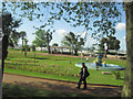
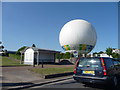
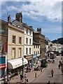
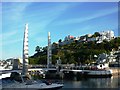

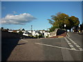
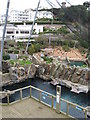
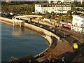

100 photos from this area
Area Information
Key information about the TQ2 5SU including its size, population, and administrative classification.
- Area Type
- Postcode
- Area Size
- 1341 m²
- Population
- 1988
- Population Density
- 4579 people/km²
House Prices in TQ2 5SU
39
Properties
£80,954
Average Sold Price
£36,500
Lowest Price
£158,000
Highest Price
Showing 39 properties
| Address | Type | Beds | Baths | Last Sale Price | Last Sale Date | |
|---|---|---|---|---|---|---|
| 3A, Coburg Place, Melville Street, Torquay, TQ2 5SU | Flat | 1 | 1 | £60,000 | Jul 2024 | |
| 6A, Coburg Place, Melville Street, Torquay, TQ2 5SU | Flat | - | - | £84,000 | Jun 2022 | |
| 7A, Coburg Place, Melville Street, Torquay, TQ2 5SU | Flat | - | - | £105,000 | Dec 2021 | |
| 9, Coburg Place, Melville Street, Torquay, TQ2 5SU | Flat | 3 | - | £105,000 | Mar 2021 | |
| 4A, Coburg Place, Melville Street, Torquay, TQ2 5SU | Maisonette | 1 | 2 | £158,000 | Dec 2019 | |
| 7, Coburg Place, Melville Street, Torquay, TQ2 5SU | Flat | - | - | £65,000 | May 2018 | |
| 3B, Coburg Place, Melville Street, Torquay, TQ2 5SU | Flat | 1 | 1 | £73,000 | Dec 2015 | |
| 2, First Floor Flat, Coburg Place, Melville Street, Torquay, TQ2 5SU | Flat | - | - | £65,000 | Jul 2013 | |
| 8A, Coburg Place, Melville Street, Torquay, TQ2 5SU | Flat | - | - | £60,000 | Jul 2008 | |
| 4B, Coburg Place, Melville Street, Torquay, TQ2 5SU | Flat | 2 | 1 | £90,000 | Apr 2007 |
Page 1 of 4
Energy Efficiency in TQ2 5SU
Amenities
Schools
| Rank | School | Type | Entry gender | Ages |
|---|
Explore more schools in this area
Go to Schools tabDemographics
Household Size
One person
most common
Accommodation Type
Flats
most common
Tenure
34
majority
Ethnic Group
White
most common
Religion
N/A
most common
Household Composition
N/A
most common
Age
47
median
Adults (30-64 years)
most common
Household Deprivation
N/A
with no deprivation
NS-SEC
24
in Lower managerial occupations
Explore more demographic insights in this area
Go to Demographics tabPlanning
Planning Constraints
- Flood RiskPremium
- Ramsar Wetland SitesPremium
- Area of Outstanding Natural BeautyPremium
- Protected Nature ReservePremium
- Protected WoodlandPremium