Area Overview for TQ2 5NP
Photos of TQ2 5NP
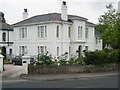
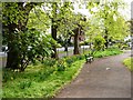
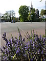
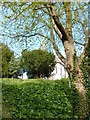
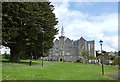
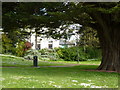
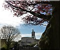
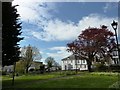
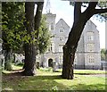
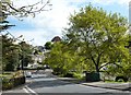
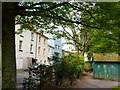
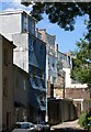
100 photos from this area
Area Information
Key information about the TQ2 5NP including its size, population, and administrative classification.
- Area Type
- Postcode
- Area Size
- 1.4 hectares
- Population
- 1988
- Population Density
- 4579 people/km²
House Prices in TQ2 5NP
100
Properties
£342,333
Average Sold Price
£202,000
Lowest Price
£575,000
Highest Price
Showing 100 properties
| Address | Type | Beds | Baths | Last Sale Price | Last Sale Date | |
|---|---|---|---|---|---|---|
| OWNERS ACCOMMODATION, LINDUM HOTEL, 105 ABBEY ROAD, Torquay, TQ2 5NP | Detached | 16 | 17 | £575,000 | Sep 2020 | |
| 117 Abbey Road, Torquay, TQ2 5NP | Terraced | - | - | £250,000 | Mar 2006 | |
| 115 Abbey Road, Torquay, TQ2 5NP | Terraced | - | - | £202,000 | Sep 2003 | |
| 2, Westwood Villa, 111 Abbey Road, Torquay, TQ2 5NP | Flat | 2 | 1 | - | - | |
| 1, Westwood Villa, 111 Abbey Road, Torquay, TQ2 5NP | Flat | 2 | 1 | - | - | |
| Flat 1, 127 Abbey Road, Torquay, TQ2 5NP | Flat | - | - | - | - | |
| Flat 7, 133 Abbey Road, Torquay, TQ2 5NP | Flat | - | - | - | - | |
| Ground Floor Flat, 84 Abbey Road, Torquay, TQ2 5NP | Flat | - | - | - | - | |
| 84B Abbey Road, Torquay, TQ2 5NP | undefined | - | - | - | - | |
| First Floor Flat, 84 Abbey Road, Torquay, TQ2 5NP | Flat | - | - | - | - |
Page 1 of 10
Energy Efficiency in TQ2 5NP
Amenities
Schools
| Rank | School | Type | Entry gender | Ages |
|---|
Explore more schools in this area
Go to Schools tabDemographics
Household Size
One person
most common
Accommodation Type
Flats
most common
Tenure
34
majority
Ethnic Group
White
most common
Religion
N/A
most common
Household Composition
N/A
most common
Age
47
median
Adults (30-64 years)
most common
Household Deprivation
N/A
with no deprivation
NS-SEC
24
in Lower managerial occupations
Explore more demographic insights in this area
Go to Demographics tabPlanning
Planning Constraints
- Flood RiskPremium
- Ramsar Wetland SitesPremium
- Area of Outstanding Natural BeautyPremium
- Protected Nature ReservePremium
- Protected WoodlandPremium