Area Overview for TQ14 9RZ
Photos of TQ14 9RZ
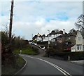
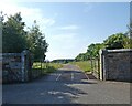
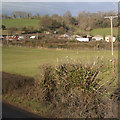
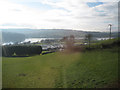
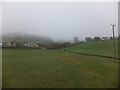


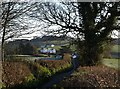
23 photos from this area
Area Information
Key information about the TQ14 9RZ including its size, population, and administrative classification.
- Area Type
- Postcode
- Area Size
- 12.8 hectares
- Population
- 1561
- Population Density
- 403 people/km²
House Prices in TQ14 9RZ
16
Properties
£447,182
Average Sold Price
£104,000
Lowest Price
£740,000
Highest Price
Showing 16 properties
| Address | Type | Beds | Baths | Last Sale Price | Last Sale Date | |
|---|---|---|---|---|---|---|
| Tree Tops, Forder Lane, Bishopsteignton, TQ14 9RZ | house | 3 | 2 | £542,000 | Oct 2023 | |
| Orchard Cottage, Forder Lane, Bishopsteignton, TQ14 9RZ | Detached | 5 | 3 | £740,000 | Mar 2021 | |
| Highridge House, Forder Lane, Bishopsteignton, TQ14 9RZ | house | - | - | £480,000 | May 2017 | |
| Brookland, Forder Lane, Bishopsteignton, TQ14 9RZ | Detached | 5 | - | £650,000 | Dec 2015 | |
| Greenways, Forder Lane, Bishopsteignton, TQ14 9RZ | Detached | 5 | - | £620,000 | May 2015 | |
| Linhay, Forder Lane, Bishopsteignton, TQ14 9RZ | Detached | 4 | - | £500,000 | Jan 2014 | |
| Hollowmead Cottage, Forder Lane, Bishopsteignton, TQ14 9RZ | house | - | - | £330,000 | Feb 2011 | |
| Murley Field, Forder Lane, Bishopsteignton, TQ14 9RZ | Bungalow | - | - | £240,000 | Jun 2010 | |
| Bramber House, Forder Lane, Bishopsteignton, TQ14 9RZ | Detached | 4 | 1 | £393,000 | Oct 2007 | |
| Meadowside, Forder Lane, Bishopsteignton, TQ14 9RZ | Detached | - | - | £320,000 | Dec 2005 |
Page 1 of 2
Energy Efficiency in TQ14 9RZ
Amenities
Schools
| Rank | School | Type | Entry gender | Ages |
|---|
Explore more schools in this area
Go to Schools tabDemographics
Household Size
Two person
most common
Accommodation Type
Houses
most common
Tenure
89
majority
Ethnic Group
White
most common
Religion
N/A
most common
Household Composition
N/A
most common
Age
47
median
Elderly (65+ years)
most common
Household Deprivation
N/A
with no deprivation
NS-SEC
42
in Lower managerial occupations
Explore more demographic insights in this area
Go to Demographics tabPlanning
Planning Constraints
- Flood RiskPremium
- Ramsar Wetland SitesPremium
- Area of Outstanding Natural BeautyPremium
- Protected Nature ReservePremium
- Protected WoodlandPremium