Area Overview for TQ14 8UT
Photos of TQ14 8UT
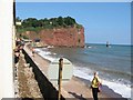
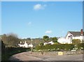
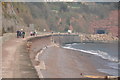
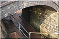
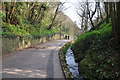
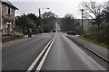
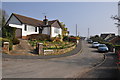
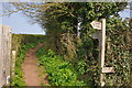

100 photos from this area
Area Information
Key information about the TQ14 8UT including its size, population, and administrative classification.
- Area Type
- Postcode
- Area Size
- 4.4 hectares
- Population
- 1838
- Population Density
- 954 people/km²
House Prices in TQ14 8UT
13
Properties
£385,883
Average Sold Price
£205,000
Lowest Price
£750,000
Highest Price
Showing 13 properties
| Address | Type | Beds | Baths | Last Sale Price | Last Sale Date | |
|---|---|---|---|---|---|---|
| 46 Teignmouth Road, Teignmouth, TQ14 8UT | Bungalow | 3 | 2 | £520,000 | Jul 2023 | |
| 58 Teignmouth Road, Teignmouth, TQ14 8UT | house | - | - | £750,000 | Aug 2022 | |
| 50 Teignmouth Road, Teignmouth, TQ14 8UT | Detached | 5 | 1 | £330,000 | Sep 2019 | |
| 48 Teignmouth Road, Teignmouth, TQ14 8UT | Bungalow | 3 | 3 | £435,000 | Jun 2019 | |
| 54 Teignmouth Road, Teignmouth, TQ14 8UT | Bungalow | 3 | 2 | £420,000 | Sep 2011 | |
| 36 Teignmouth Road, Teignmouth, TQ14 8UT | Detached | 3 | 2 | £299,950 | Nov 2006 | |
| 44 Teignmouth Road, Teignmouth, TQ14 8UT | Bungalow | 4 | - | £205,000 | Jul 2006 | |
| 42 Teignmouth Road, Teignmouth, TQ14 8UT | Detached | - | - | £280,000 | May 2004 | |
| 40 Teignmouth Road, Teignmouth, TQ14 8UT | Detached | - | - | £233,000 | Oct 2002 | |
| First Floor Flat, 60 Teignmouth Road, Bishopsteignton, TQ14 8UT | Detached | 5 | 4 | - | - |
Page 1 of 2
Energy Efficiency in TQ14 8UT
Amenities
Schools
| Rank | School | Type | Entry gender | Ages |
|---|
Explore more schools in this area
Go to Schools tabDemographics
Household Size
Two person
most common
Accommodation Type
Houses
most common
Tenure
89
majority
Ethnic Group
White
most common
Religion
N/A
most common
Household Composition
N/A
most common
Age
47
median
Elderly (65+ years)
most common
Household Deprivation
N/A
with no deprivation
NS-SEC
43
in Lower managerial occupations
Explore more demographic insights in this area
Go to Demographics tabPlanning
Planning Constraints
- Flood RiskPremium
- Ramsar Wetland SitesPremium
- Area of Outstanding Natural BeautyPremium
- Protected Nature ReservePremium
- Protected WoodlandPremium