Area Overview for TQ14 0AT
Photos of TQ14 0AT
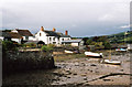
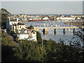
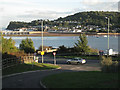
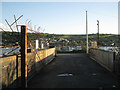
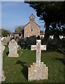
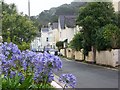
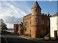
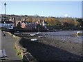
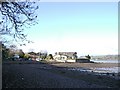
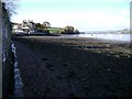
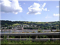
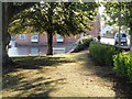
100 photos from this area
Area Information
Key information about the TQ14 0AT including its size, population, and administrative classification.
- Area Type
- Postcode
- Area Size
- 8293 m²
- Population
- 1236
- Population Density
- 846 people/km²
House Prices in TQ14 0AT
22
Properties
£391,000
Average Sold Price
£95,500
Lowest Price
£605,000
Highest Price
Showing 22 properties
| Address | Type | Beds | Baths | Last Sale Price | Last Sale Date | |
|---|---|---|---|---|---|---|
| Elm Cottage, Topcliff Road, Shaldon, TQ14 0AT | house | 4 | - | £550,000 | Jun 2021 | |
| 5 Topcliff Road, Shaldon, TQ14 0AT | Bungalow | - | - | £605,000 | Mar 2021 | |
| 1A Topcliff Road, Shaldon, TQ14 0AT | Detached | 2 | 2 | £400,000 | Sep 2018 | |
| Rozel, Topcliff Road, Shaldon, TQ14 0AT | house | - | - | £560,000 | Aug 2016 | |
| 4 Topcliff Road, Shaldon, TQ14 0AT | Detached | 3 | - | £485,000 | Jan 2014 | |
| 6 Topcliff Road, Shaldon, TQ14 0AT | Bungalow | - | - | £422,500 | Nov 2011 | |
| 2 Topcliff Road, Shaldon, TQ14 0AT | Detached | - | - | £387,000 | Jul 2008 | |
| 3 Topcliff Road, Shaldon, TQ14 0AT | Detached | - | - | £235,000 | Apr 2004 | |
| Elmbank, Topcliff Road, Shaldon, TQ14 0AT | house | - | - | £95,500 | Feb 1998 | |
| Bridge House, Topcliff Road, Shaldon, TQ14 0AT | house | - | - | £170,000 | Feb 1997 |
Page 1 of 3
Energy Efficiency in TQ14 0AT
Amenities
Schools
| Rank | School | Type | Entry gender | Ages |
|---|
Explore more schools in this area
Go to Schools tabDemographics
Household Size
Two person
most common
Accommodation Type
Houses
most common
Tenure
79
majority
Ethnic Group
White
most common
Religion
N/A
most common
Household Composition
N/A
most common
Age
47
median
Elderly (65+ years)
most common
Household Deprivation
N/A
with no deprivation
NS-SEC
42
in Lower managerial occupations
Explore more demographic insights in this area
Go to Demographics tabPlanning
Planning Constraints
- Flood RiskPremium
- Ramsar Wetland SitesPremium
- Area of Outstanding Natural BeautyPremium
- Protected Nature ReservePremium
- Protected WoodlandPremium