Area Overview for TQ14 0AD
Photos of TQ14 0AD

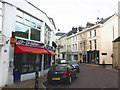
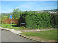
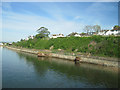
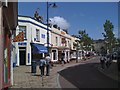
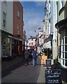
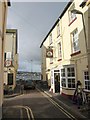
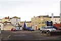

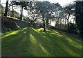
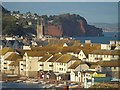
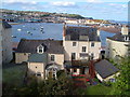
100 photos from this area
Area Information
Key information about the TQ14 0AD including its size, population, and administrative classification.
- Area Type
- Postcode
- Area Size
- 7683 m²
- Population
- 1236
- Population Density
- 846 people/km²
House Prices in TQ14 0AD
27
Properties
£246,353
Average Sold Price
£134,500
Lowest Price
£455,000
Highest Price
Showing 27 properties
| Address | Type | Beds | Baths | Last Sale Price | Last Sale Date | |
|---|---|---|---|---|---|---|
| 7 Clifford Close, Shaldon, TQ14 0AD | Terraced | 3 | 1 | £293,500 | Nov 2025 | |
| Fernlea B1, Clifford Close, Shaldon, TQ14 0AD | Semi-detached | 3 | 1 | £455,000 | May 2024 | |
| 9 Clifford Close, Shaldon, TQ14 0AD | Terraced | 2 | 1 | £273,000 | Jun 2019 | |
| Bridge View, Clifford Close, Shaldon, TQ14 0AD | Bungalow | - | - | £451,250 | Nov 2017 | |
| 4 Clifford Close, Shaldon, TQ14 0AD | Terraced | - | - | £250,000 | Aug 2016 | |
| 2 Clifford Close, Shaldon, TQ14 0AD | house | - | - | £200,000 | Sep 2015 | |
| 3 Clifford Close, Shaldon, TQ14 0AD | house | 2 | - | £245,000 | Jan 2015 | |
| 13 Clifford Close, Shaldon, TQ14 0AD | house | - | - | £220,000 | Apr 2013 | |
| 18 Clifford Close, Shaldon, TQ14 0AD | Semi-detached | 3 | - | £225,000 | Aug 2012 | |
| 5 Clifford Close, Shaldon, TQ14 0AD | Terraced | 3 | - | £215,000 | Nov 2009 |
Page 1 of 3
Energy Efficiency in TQ14 0AD
Amenities
Schools
| Rank | School | Type | Entry gender | Ages |
|---|
Explore more schools in this area
Go to Schools tabDemographics
Household Size
Two person
most common
Accommodation Type
Houses
most common
Tenure
79
majority
Ethnic Group
White
most common
Religion
N/A
most common
Household Composition
N/A
most common
Age
47
median
Elderly (65+ years)
most common
Household Deprivation
N/A
with no deprivation
NS-SEC
42
in Lower managerial occupations
Explore more demographic insights in this area
Go to Demographics tabPlanning
Planning Constraints
- Flood RiskPremium
- Ramsar Wetland SitesPremium
- Area of Outstanding Natural BeautyPremium
- Protected Nature ReservePremium
- Protected WoodlandPremium