Area Overview for TQ13 9QE
Photos of TQ13 9QE
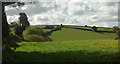
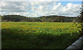
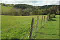
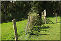
48 photos from this area
Area Information
Key information about the TQ13 9QE including its size, population, and administrative classification.
- Area Type
- Postcode
- Area Size
- 85.9 hectares
- Population
- 1810
- Population Density
- 113 people/km²
House Prices in TQ13 9QE
16
Properties
£245,833
Average Sold Price
£37,500
Lowest Price
£535,000
Highest Price
Showing 16 properties
| Address | Type | Beds | Baths | Last Sale Price | Last Sale Date | |
|---|---|---|---|---|---|---|
| Twizzle Tree Cottage, Road From Bell Lane To Church Road, Hennock, Bovey Tracey, TQ13 9QE | Cottage | 2 | 1 | £535,000 | Aug 2018 | |
| Lakes Cottage, Church Road, Hennock, Bovey Tracey, TQ13 9QE | Terraced | - | - | £165,000 | Feb 2002 | |
| Old Slade Cottage, Church Road, Hennock, Bovey Tracey, TQ13 9QE | Terraced | - | - | £37,500 | Nov 1998 | |
| Longlands, Road From Palk Arms To Butt Park, Hennock, Bovey Tracey, TQ13 9QE | Semi-detached | 1 | 2 | - | - | |
| Great Rock Farm, Road From Bell Lane To Church Road, Hennock, Bovey Tracey, TQ13 9QE | Detached | 3 | 2 | - | - | |
| The Long House, Longlands, Road From Palk Arms To Butt Park, Hennock, Bovey Tracey, TQ13 9QE | house | - | - | - | - | |
| Primrose, Great Rock Farm, Road From Bell Lane To Church Road, Hennock, Bovey Tracey, TQ13 9QE | house | - | - | - | - | |
| The Barn, Longlands, Road From Palk Arms To Butt Park, Hennock, Bovey Tracey, TQ13 9QE | office_workshop | - | - | - | - | |
| Longlands Cottage, Church Road, Hennock, Bovey Tracey, TQ13 9QE | Cottage | 4 | 2 | - | - | |
| Weavers Hill, Church Road, Hennock, Bovey Tracey, TQ13 9QE | Detached | - | - | - | - |
Page 1 of 2
Energy Efficiency in TQ13 9QE
Amenities
Schools
| Rank | School | Type | Entry gender | Ages |
|---|
Explore more schools in this area
Go to Schools tabDemographics
Household Size
Two person
most common
Accommodation Type
Houses
most common
Tenure
76
majority
Ethnic Group
White
most common
Religion
N/A
most common
Household Composition
N/A
most common
Age
47
median
Adults (30-64 years)
most common
Household Deprivation
N/A
with no deprivation
NS-SEC
34
in Lower managerial occupations
Explore more demographic insights in this area
Go to Demographics tabPlanning
Planning Constraints
- Flood RiskPremium
- Ramsar Wetland SitesPremium
- Area of Outstanding Natural BeautyPremium
- Protected Nature ReservePremium
- Protected WoodlandPremium