Area Overview for TQ13 9LL
Photos of TQ13 9LL

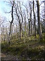
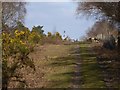
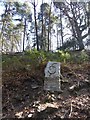
83 photos from this area
Area Information
Key information about the TQ13 9LL including its size, population, and administrative classification.
- Area Type
- Postcode
- Area Size
- 62.9 hectares
- Population
- 1415
- Population Density
- 45 people/km²
House Prices in TQ13 9LL
22
Properties
£668,500
Average Sold Price
£447,500
Lowest Price
£1,000,000
Highest Price
Showing 22 properties
| Address | Type | Beds | Baths | Last Sale Price | Last Sale Date | |
|---|---|---|---|---|---|---|
| Torling, Haytor Road, Bovey Tracey, TQ13 9LL | Detached | 4 | 4 | £1,000,000 | Dec 2025 | |
| 2, Ullacombe Cottages, Haytor Road, Bovey Tracey, TQ13 9LL | house | - | - | £700,000 | Jul 2022 | |
| Briarbank, Haytor Road, Bovey Tracey, TQ13 9LL | Bungalow | 3 | - | £450,000 | Sep 2015 | |
| Linghaven House, Haytor Road, Bovey Tracey, TQ13 9LL | house | 3 | - | £617,000 | Mar 2014 | |
| Bracken Hill, Haytor Road, Bovey Tracey, TQ13 9LL | Land | 7 | - | £890,000 | Aug 2010 | |
| The Brook, Haytor Road, Bovey Tracey, TQ13 9LL | Detached | - | - | £447,500 | May 2009 | |
| Brambles, Road From Lowerdown Pottery To Fire Station, Bovey Tracey, TQ13 9LL | house | - | - | £575,000 | Nov 2006 | |
| Ullacombe House, Haytor Road, Bovey Tracey, TQ13 9LL | Maisonette | 5 | - | - | - | |
| Furzeacre, Haytor Road, Bovey Tracey, TQ13 9LL | Detached | - | - | - | - | |
| First Floor Flat, Ullacombe House, Haytor Road, Bovey Tracey, TQ13 9LL | Flat | - | - | - | - |
Page 1 of 3
Energy Efficiency in TQ13 9LL
Amenities
Schools
| Rank | School | Type | Entry gender | Ages |
|---|
Explore more schools in this area
Go to Schools tabDemographics
Household Size
Two person
most common
Accommodation Type
Houses
most common
Tenure
88
majority
Ethnic Group
White
most common
Religion
N/A
most common
Household Composition
N/A
most common
Age
47
median
Adults (30-64 years)
most common
Household Deprivation
N/A
with no deprivation
NS-SEC
47
in Lower managerial occupations
Explore more demographic insights in this area
Go to Demographics tabPlanning
Planning Constraints
- Flood RiskPremium
- Ramsar Wetland SitesPremium
- Area of Outstanding Natural BeautyPremium
- Protected Nature ReservePremium