Area Overview for TQ13 7EA
Photos of TQ13 7EA
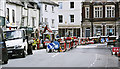
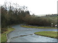
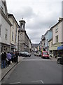
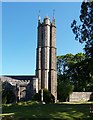
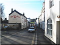
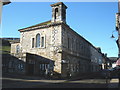
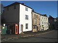
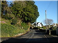
100 photos from this area
Area Information
Key information about the TQ13 7EA including its size, population, and administrative classification.
- Area Type
- Postcode
- Area Size
- 10.6 hectares
- Population
- 1721
- Population Density
- 1347 people/km²
House Prices in TQ13 7EA
17
Properties
£327,056
Average Sold Price
£99,000
Lowest Price
£640,000
Highest Price
Showing 17 properties
| Address | Type | Beds | Baths | Last Sale Price | Last Sale Date | |
|---|---|---|---|---|---|---|
| 4 Bowden Hill, Ashburton, TQ13 7EA | house | 3 | 1 | £400,000 | Apr 2023 | |
| St Benets, Bowden Hill, Ashburton, TQ13 7EA | Detached | 3 | - | £640,000 | Nov 2022 | |
| 2 Bowden Hill, Ashburton, TQ13 7EA | Land | - | - | £350,000 | Dec 2020 | |
| Ashcroft, Bowden Hill, Ashburton, TQ13 7EA | Bungalow | 5 | - | £432,000 | Jul 2016 | |
| Slade Park, Bowden Hill, Ashburton, TQ13 7EA | house | - | - | £450,000 | Jul 2006 | |
| Felstead, 5 Bowden Hill, Ashburton, TQ13 7EA | Detached | 2 | 1 | £267,500 | Jun 2006 | |
| Swiss Chalet, Bowden Hill, Ashburton, TQ13 7EA | house | - | - | £195,000 | Jan 2002 | |
| 6 Bowden Hill, Ashburton, TQ13 7EA | Detached | - | - | £110,000 | Jul 2000 | |
| Walldene, Bowden Hill, Ashburton, TQ13 7EA | house | - | - | £99,000 | Dec 1997 | |
| Hillcrest, Bowden Hill, Ashburton, TQ13 7EA | Detached | 4 | - | - | - |
Page 1 of 2
Energy Efficiency in TQ13 7EA
Amenities
Schools
| Rank | School | Type | Entry gender | Ages |
|---|
Explore more schools in this area
Go to Schools tabDemographics
Household Size
One person
most common
Accommodation Type
Houses
most common
Tenure
55
majority
Ethnic Group
White
most common
Religion
N/A
most common
Household Composition
N/A
most common
Age
47
median
Adults (30-64 years)
most common
Household Deprivation
N/A
with no deprivation
NS-SEC
35
in Lower managerial occupations
Explore more demographic insights in this area
Go to Demographics tabPlanning
Planning Constraints
- Flood RiskPremium
- Ramsar Wetland SitesPremium
- Area of Outstanding Natural BeautyPremium
- Protected Nature ReservePremium
- Protected WoodlandPremium