Area Overview for TQ13 0BE
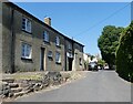
Photos of TQ13 0BE
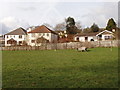
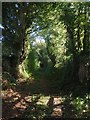
![Path to Rixafer Road [1] in TQ13 0BE](https://images.propbar.co.uk/images/geograph/54/35/5435254_120.jpg)
95 photos from this area
Area Information
Key information about the TQ13 0BE including its size, population, and administrative classification.
- Area Type
- Postcode
- Area Size
- 2.7 hectares
- Population
- 1511
- Population Density
- 155 people/km²
House Prices in TQ13 0BE
15
Properties
£265,571
Average Sold Price
£140,000
Lowest Price
£520,000
Highest Price
Showing 15 properties
| Address | Type | Beds | Baths | Last Sale Price | Last Sale Date | |
|---|---|---|---|---|---|---|
| Apple Cottage, Fore Street, Ideford, Chudleigh, TQ13 0BE | Cottage | 3 | 2 | £520,000 | Mar 2025 | |
| Wayland Cottage, Fore Street, Ideford, Chudleigh, TQ13 0BE | Terraced | 2 | - | £247,500 | Jun 2013 | |
| 5 Fore Street, Ideford, Chudleigh, TQ13 0BE | house | 2 | - | £250,000 | Dec 2012 | |
| 8 Fore Street, Ideford, Chudleigh, TQ13 0BE | Terraced | 2 | - | £140,000 | Jul 2006 | |
| Ty Gwyn, Fore Street, Ideford, Chudleigh, TQ13 0BE | Maisonette | 2 | - | £298,000 | Jun 2003 | |
| Cherry Trees, Fore Street, Ideford, Chudleigh, TQ13 0BE | Terraced | - | - | £240,000 | Mar 2003 | |
| Greenacre, Fore Street, Ideford, Chudleigh, TQ13 0BE | Detached | - | - | £163,500 | Mar 1999 | |
| Willow Cottage, 9 Fore Street, Ideford, Chudleigh, TQ13 0BE | Terraced | 3 | - | - | - | |
| 7 Fore Street, Ideford, Chudleigh, TQ13 0BE | Flat | - | - | - | - | |
| Chudleigh Scout Hut, Fore Street, Chudleigh, TQ13 0BE | commercial | - | - | - | - |
Page 1 of 2
Energy Efficiency in TQ13 0BE
Amenities
Schools
| Rank | School | Type | Entry gender | Ages |
|---|
Explore more schools in this area
Go to Schools tabDemographics
Household Size
Two person
most common
Accommodation Type
Houses
most common
Tenure
82
majority
Ethnic Group
White
most common
Religion
N/A
most common
Household Composition
N/A
most common
Age
47
median
Adults (30-64 years)
most common
Household Deprivation
N/A
with no deprivation
NS-SEC
38
in Lower managerial occupations
Explore more demographic insights in this area
Go to Demographics tabPlanning
Planning Constraints
- Flood RiskPremium
- Ramsar Wetland SitesPremium
- Area of Outstanding Natural BeautyPremium
- Protected Nature ReservePremium
- Protected WoodlandPremium