Area Overview for TQ12 5UR
Photos of TQ12 5UR
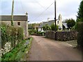
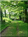

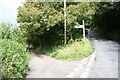
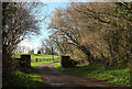


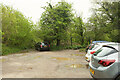


71 photos from this area
Area Information
Key information about the TQ12 5UR including its size, population, and administrative classification.
- Area Type
- Postcode
- Area Size
- 66.6 hectares
- Population
- 2007
- Population Density
- 155 people/km²
House Prices in TQ12 5UR
21
Properties
£290,313
Average Sold Price
£65,000
Lowest Price
£650,000
Highest Price
Showing 21 properties
| Address | Type | Beds | Baths | Last Sale Price | Last Sale Date | |
|---|---|---|---|---|---|---|
| The Tors, Road From Torbryan Cross To Broadway Cross, Torbryan, TQ12 5UR | house | - | - | £525,000 | May 2023 | |
| Thatchings, Road From Torbryan Cross To Broadway Cross, Torbryan, TQ12 5UR | Cottage | 3 | 1 | £281,500 | Jan 2021 | |
| Cobweb Cottage, Road From Torbryan Cross To Broadway Cross, Torbryan, TQ12 5UR | Terraced | - | - | £323,000 | Feb 2018 | |
| Spring Cottage, Road From Torbryan Cross To Broadway Cross, Torbryan, TQ12 5UR | Cottage | 2 | 1 | £180,000 | Feb 2014 | |
| St Francis Cottage, Road From Torbryan Cross To Broadway Cross, Torbryan, TQ12 5UR | Detached | - | - | £650,000 | Nov 2007 | |
| 1, Binkwell Cottages, Road To Bramble Bank, Torbryan, TQ12 5UR | Terraced | - | - | £185,000 | Mar 2005 | |
| Woodhill Cottage, Road To Bramble Bank, Torbryan, TQ12 5UR | Detached | 3 | 1 | £65,000 | Jun 1995 | |
| Orchard House, Road To Bramble Bank, Torbryan, TQ12 5UR | Detached | - | - | £113,000 | Mar 1995 | |
| Tor Court Farm, Road To Bramble Bank, Torbryan, TQ12 5UR | Detached | 4 | 1 | - | - | |
| 2, Binkwell Cottages, Road To Bramble Bank, Torbryan, TQ12 5UR | undefined | - | - | - | - |
Page 1 of 3
Energy Efficiency in TQ12 5UR
Amenities
Schools
| Rank | School | Type | Entry gender | Ages |
|---|
Explore more schools in this area
Go to Schools tabDemographics
Household Size
Two person
most common
Accommodation Type
Houses
most common
Tenure
71
majority
Ethnic Group
White
most common
Religion
N/A
most common
Household Composition
N/A
most common
Age
47
median
Adults (30-64 years)
most common
Household Deprivation
N/A
with no deprivation
NS-SEC
29
in Lower managerial occupations
Explore more demographic insights in this area
Go to Demographics tabPlanning
Planning Constraints
- Flood RiskPremium
- Ramsar Wetland SitesPremium
- Area of Outstanding Natural BeautyPremium
- Protected Nature ReservePremium
- Protected WoodlandPremium