Area Overview for TQ12 5QL
Photos of TQ12 5QL
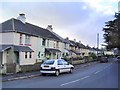
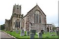
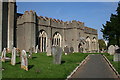
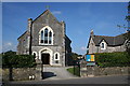
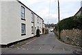
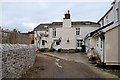
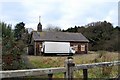
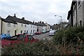
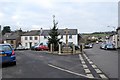
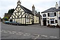
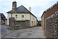
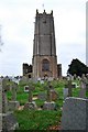
100 photos from this area
Area Information
Key information about the TQ12 5QL including its size, population, and administrative classification.
- Area Type
- Postcode
- Area Size
- 9.1 hectares
- Population
- 1314
- Population Density
- 117 people/km²
House Prices in TQ12 5QL
17
Properties
£294,444
Average Sold Price
£78,000
Lowest Price
£412,500
Highest Price
Showing 17 properties
| Address | Type | Beds | Baths | Last Sale Price | Last Sale Date | |
|---|---|---|---|---|---|---|
| 26 Biltor Road, Ipplepen, TQ12 5QL | Bungalow | 3 | 1 | £412,500 | Dec 2022 | |
| 29 Biltor Road, Ipplepen, TQ12 5QL | Retail | 3 | 1 | £385,000 | Apr 2022 | |
| 27 Biltor Road, Ipplepen, TQ12 5QL | Bungalow | 3 | 2 | £283,000 | Jun 2019 | |
| 28 Biltor Road, Ipplepen, TQ12 5QL | Bungalow | 3 | 2 | £286,000 | Feb 2017 | |
| The Old Coach House, Biltor Road, Ipplepen, TQ12 5QL | Detached | 5 | 2 | £390,000 | Dec 2016 | |
| Edgelands View, Biltor Road, Ipplepen, TQ12 5QL | house | - | - | £297,500 | Dec 2016 | |
| 30 Biltor Road, Ipplepen, TQ12 5QL | Bungalow | - | - | £242,500 | Nov 2011 | |
| Springfield, Biltor Road, Ipplepen, TQ12 5QL | Detached | - | - | £275,500 | Jun 2006 | |
| Coombe Orchard, 1 Biltor Road, Ipplepen, TQ12 5QL | Detached | - | - | £78,000 | Apr 1998 | |
| 25 Biltor Road, Ipplepen, TQ12 5QL | Bungalow | 2 | 1 | - | - |
Page 1 of 2
Energy Efficiency in TQ12 5QL
Amenities
Schools
| Rank | School | Type | Entry gender | Ages |
|---|
Explore more schools in this area
Go to Schools tabDemographics
Household Size
Two person
most common
Accommodation Type
Houses
most common
Tenure
84
majority
Ethnic Group
White
most common
Religion
N/A
most common
Household Composition
N/A
most common
Age
47
median
Adults (30-64 years)
most common
Household Deprivation
N/A
with no deprivation
NS-SEC
38
in Lower managerial occupations
Explore more demographic insights in this area
Go to Demographics tabPlanning
Planning Constraints
- Flood RiskPremium
- Ramsar Wetland SitesPremium
- Area of Outstanding Natural BeautyPremium
- Protected Nature ReservePremium
- Protected WoodlandPremium