Area Overview for TQ12 4RT
Photos of TQ12 4RT
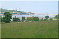
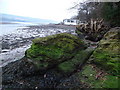
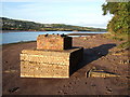
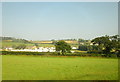
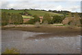
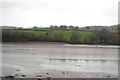
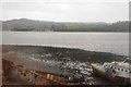
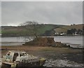
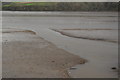
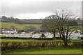

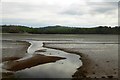
102 photos from this area
Area Information
Key information about the TQ12 4RT including its size, population, and administrative classification.
- Area Type
- Postcode
- Area Size
- 79.5 hectares
- Population
- 1561
- Population Density
- 403 people/km²
House Prices in TQ12 4RT
8
Properties
£408,200
Average Sold Price
£285,000
Lowest Price
£590,000
Highest Price
Showing 8 properties
| Address | Type | Beds | Baths | Last Sale Price | Last Sale Date | |
|---|---|---|---|---|---|---|
| Barbaree, Road From Coombe Cellars To Heron Cottage, Combeinteignhead, TQ12 4RT | Bungalow | 2 | 1 | £285,000 | Jul 2025 | |
| 2, Holywell Cottages, Road From Coombe Cellars To Heron Cottage, Combeinteignhead, TQ12 4RT | house | - | - | £306,000 | Aug 2021 | |
| The Wilderness, Road From Coombe Cellars To Heron Cottage, Combeinteignhead, TQ12 4RT | Detached | 4 | 2 | £590,000 | Jun 2020 | |
| Watersedge, Road From Coombe Cellars To Heron Cottage, Combeinteignhead, TQ12 4RT | Detached | 4 | 2 | £400,000 | Nov 2017 | |
| Holywell House, Road From Coombe Cellars To Heron Cottage, Combeinteignhead, TQ12 4RT | Terraced | 5 | 3 | £460,000 | May 2017 | |
| 1, Holywell Cottages, Road From Coombe Cellars To Heron Cottage, Combeinteignhead, TQ12 4RT | Terraced | - | - | - | - | |
| Rest A While, Road From Coombe Cellars To Heron Cottage, Combeinteignhead, TQ12 4RT | Detached | - | - | - | - | |
| Mangares Flat, Coombe Cellars, Road From Coombe Cellars To Heron Cottage, Combeinteignhead, TQ12 4RT | Flat | - | - | - | - |
Energy Efficiency in TQ12 4RT
Amenities
Schools
| Rank | School | Type | Entry gender | Ages |
|---|
Explore more schools in this area
Go to Schools tabDemographics
Household Size
Two person
most common
Accommodation Type
Houses
most common
Tenure
89
majority
Ethnic Group
White
most common
Religion
N/A
most common
Household Composition
N/A
most common
Age
47
median
Elderly (65+ years)
most common
Household Deprivation
N/A
with no deprivation
NS-SEC
42
in Lower managerial occupations
Explore more demographic insights in this area
Go to Demographics tabPlanning
Planning Constraints
- Flood RiskPremium
- Ramsar Wetland SitesPremium
- Area of Outstanding Natural BeautyPremium
- Protected Nature ReservePremium
- Protected WoodlandPremium