Area Overview for TQ10 9NH
Photos of TQ10 9NH
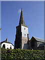
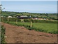


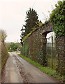
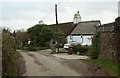
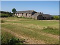
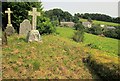

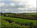
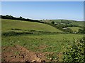
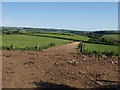
21 photos from this area
Area Information
Key information about the TQ10 9NH including its size, population, and administrative classification.
- Area Type
- Postcode
- Area Size
- 26.2 hectares
- Population
- 2466
- Population Density
- 46 people/km²
House Prices in TQ10 9NH
13
Properties
£552,500
Average Sold Price
£320,000
Lowest Price
£785,000
Highest Price
Showing 13 properties
| Address | Type | Beds | Baths | Last Sale Price | Last Sale Date | |
|---|---|---|---|---|---|---|
| Burnt Pine Cottage, North Huish To Butterford Mill Cross, North Huish, TQ10 9NH | Detached | 3 | 2 | £785,000 | Dec 2024 | |
| Huish Barn, North Huish Road, North Huish, TQ10 9NH | Land | 2 | 1 | £320,000 | Mar 2019 | |
| 7, The Laurels, The Village, North Huish Road, North Huish, TQ10 9NH | house | 3 | 1 | - | - | |
| Manor Barn, North Huish Road, North Huish, TQ10 9NH | house | 4 | - | - | - | |
| Caravan, Huish Barn, North Huish Road, North Huish, TQ10 9NH | undefined | - | - | - | - | |
| 1, The Village, North Huish Road, North Huish, TQ10 9NH | house | - | - | - | - | |
| 4, The Village, North Huish Road, North Huish, TQ10 9NH | Terraced | - | - | - | - | |
| 5, The Village, North Huish Road, North Huish, TQ10 9NH | Semi-detached | - | - | - | - | |
| 2, The Village, North Huish Road, North Huish, TQ10 9NH | Terraced | - | - | - | - | |
| 3, The Village, North Huish Road, North Huish, TQ10 9NH | Terraced | - | - | - | - |
Page 1 of 2
Energy Efficiency in TQ10 9NH
Amenities
Schools
| Rank | School | Type | Entry gender | Ages |
|---|
Explore more schools in this area
Go to Schools tabDemographics
Household Size
Two person
most common
Accommodation Type
Houses
most common
Tenure
73
majority
Ethnic Group
White
most common
Religion
N/A
most common
Household Composition
N/A
most common
Age
47
median
Adults (30-64 years)
most common
Household Deprivation
N/A
with no deprivation
NS-SEC
43
in Lower managerial occupations
Explore more demographic insights in this area
Go to Demographics tabPlanning
Planning Constraints
- Flood RiskPremium
- Ramsar Wetland SitesPremium
- Area of Outstanding Natural BeautyPremium
- Protected Nature ReservePremium
- Protected WoodlandPremium