Area Overview for TQ10 9JT
Photos of TQ10 9JT
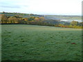
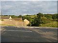

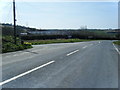
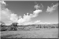
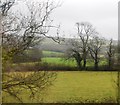
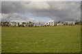
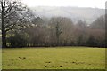
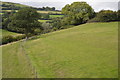


35 photos from this area
Area Information
Key information about the TQ10 9JT including its size, population, and administrative classification.
- Area Type
- Postcode
- Area Size
- 31.6 hectares
- Population
- 1142
- Population Density
- 99 people/km²
House Prices in TQ10 9JT
21
Properties
£225,500
Average Sold Price
£161,000
Lowest Price
£290,000
Highest Price
Showing 21 properties
| Address | Type | Beds | Baths | Last Sale Price | Last Sale Date | |
|---|---|---|---|---|---|---|
| Little Stidston, Road To Marley Grange, South Brent, TQ10 9JT | Semi-detached | 3 | 1 | £290,000 | May 2019 | |
| Badgers Holt, Road To Marley Grange, South Brent, TQ10 9JT | Semi-detached | 2 | - | £161,000 | Jan 2014 | |
| West Barn, Stidston, Stidston Cross At B 3372 To Portfield Lane, South Brent, TQ10 9JT | Semi-detached | 3 | 2 | - | - | |
| East Barn, Stidston, Stidston Cross At B 3372 To Portfield Lane, South Brent, TQ10 9JT | barn | 3 | 2 | - | - | |
| Foxes Den, Marley Grange, Road To Marley Grange, South Brent, TQ10 9JT | Semi-detached | 3 | 2 | - | - | |
| Woodpecker, Marley Grange, Road To Marley Grange, South Brent, TQ10 9JT | Semi-detached | 3 | - | - | - | |
| Marley Grange, Road To Marley Grange, South Brent, TQ10 9JT | Land | 4 | - | - | - | |
| Wild Flowers, Stidston Cross At B 3372 To Portfield Lane, South Brent, TQ10 9JT | Bungalow | 3 | - | - | - | |
| Thorn Meadow Caravan, Stidston Cross At B 3372 To Portfield Lane, South Brent, TQ10 9JT | Land | - | - | - | - | |
| Brook Cottage, Stidston, Road To Marley Grange, South Brent, TQ10 9JT | Terraced | 3 | - | - | - |
Page 1 of 3
Energy Efficiency in TQ10 9JT
Amenities
Schools
| Rank | School | Type | Entry gender | Ages |
|---|
Explore more schools in this area
Go to Schools tabDemographics
Household Size
Two person
most common
Accommodation Type
Houses
most common
Tenure
78
majority
Ethnic Group
White
most common
Religion
N/A
most common
Household Composition
N/A
most common
Age
47
median
Adults (30-64 years)
most common
Household Deprivation
N/A
with no deprivation
NS-SEC
44
in Lower managerial occupations
Explore more demographic insights in this area
Go to Demographics tabPlanning
Planning Constraints
- Flood RiskPremium
- Ramsar Wetland SitesPremium
- Area of Outstanding Natural BeautyPremium
- Protected Nature ReservePremium
- Protected WoodlandPremium