Area Overview for TQ10 9DT
Photos of TQ10 9DT

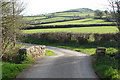
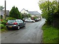
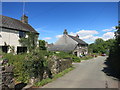
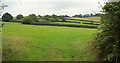
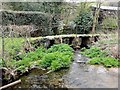
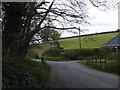
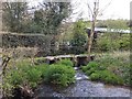
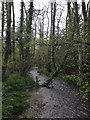
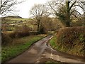
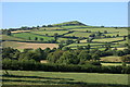
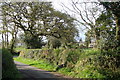
16 photos from this area
Area Information
Key information about the TQ10 9DT including its size, population, and administrative classification.
- Area Type
- Postcode
- Area Size
- 83.4 hectares
- Population
- 2488
- Population Density
- 22 people/km²
House Prices in TQ10 9DT
19
Properties
£376,250
Average Sold Price
£180,000
Lowest Price
£645,000
Highest Price
Showing 19 properties
| Address | Type | Beds | Baths | Last Sale Price | Last Sale Date | |
|---|---|---|---|---|---|---|
| Harbourneford Lodge, Dean Cross To Harbourneford Cross, Harbourneford, TQ10 9DT | Semi-detached | 1 | 1 | £645,000 | Mar 2019 | |
| Courtledge Cottage, Dean Cross To Harbourneford Cross, Harbourneford, TQ10 9DT | house | - | - | £370,000 | Mar 2007 | |
| Mill Cottage, Dean Cross To Harbourneford Cross, Harbourneford, TQ10 9DT | house | 4 | - | £180,000 | May 2002 | |
| Court Gate House, Dean Cross To Harbourneford Cross, Harbourneford, TQ10 9DT | Terraced | - | - | £310,000 | Nov 1999 | |
| Meadow Cottage, Dean Cross To Harbourneford Cross, Harbourneford, TQ10 9DT | Detached | 4 | 2 | - | - | |
| Court Gate Cottage, Dean Cross To Harbourneford Cross, Harbourneford, TQ10 9DT | Land | 2 | 1 | - | - | |
| Court Gate Farm, Dean Cross To Harbourneford Cross, Harbourneford, TQ10 9DT | Detached | 3 | - | - | - | |
| The Granary, Dean Cross To Harbourneford Cross, Harbourneford, TQ10 9DT | Semi-detached | 5 | 3 | - | - | |
| Swallows, Dean Cross To Harbourneford Cross, Harbourneford, TQ10 9DT | Semi-detached | 1 | - | - | - | |
| The Hayloft, Dean Cross To Harbourneford Cross, Harbourneford, TQ10 9DT | house | - | - | - | - |
Page 1 of 2
Energy Efficiency in TQ10 9DT
Amenities
Schools
| Rank | School | Type | Entry gender | Ages |
|---|
Explore more schools in this area
Go to Schools tabDemographics
Household Size
Two person
most common
Accommodation Type
Houses
most common
Tenure
77
majority
Ethnic Group
White
most common
Religion
N/A
most common
Household Composition
N/A
most common
Age
47
median
Adults (30-64 years)
most common
Household Deprivation
N/A
with no deprivation
NS-SEC
43
in Lower managerial occupations
Explore more demographic insights in this area
Go to Demographics tabPlanning
Planning Constraints
- Flood RiskPremium
- Ramsar Wetland SitesPremium
- Area of Outstanding Natural BeautyPremium
- Protected Nature ReservePremium
- Protected WoodlandPremium