Area Overview for TQ1 3ES
Photos of TQ1 3ES
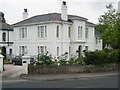
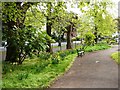
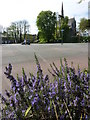
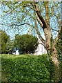
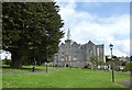
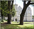
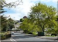
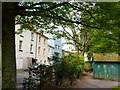
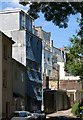
100 photos from this area
Area Information
Key information about the TQ1 3ES including its size, population, and administrative classification.
- Area Type
- Postcode
- Area Size
- 5974 m²
- Population
- 1701
- Population Density
- 6807 people/km²
House Prices in TQ1 3ES
20
Properties
£108,263
Average Sold Price
£32,000
Lowest Price
£196,000
Highest Price
Showing 20 properties
| Address | Type | Beds | Baths | Last Sale Price | Last Sale Date | |
|---|---|---|---|---|---|---|
| 39 Upton Hill, Torquay, TQ1 3ES | house | - | - | £132,500 | May 2025 | |
| 71 Upton Hill, Torquay, TQ1 3ES | Terraced | 3 | 1 | £196,000 | Feb 2025 | |
| 67 Upton Hill, Torquay, TQ1 3ES | Terraced | 3 | - | £174,500 | Jan 2024 | |
| 73 Upton Hill, Torquay, TQ1 3ES | Terraced | 3 | 1 | £180,000 | Feb 2022 | |
| 55 Upton Hill, Torquay, TQ1 3ES | Terraced | 3 | - | £187,500 | Sep 2021 | |
| 63 Upton Hill, Torquay, TQ1 3ES | Terraced | 3 | - | £134,000 | Sep 2014 | |
| 57 Upton Hill, Torquay, TQ1 3ES | Terraced | 3 | - | £130,000 | Aug 2014 | |
| 53 Upton Hill, Torquay, TQ1 3ES | Terraced | 3 | - | £120,000 | Jul 2013 | |
| 45 Upton Hill, Torquay, TQ1 3ES | Terraced | 3 | 1 | £90,000 | Dec 2010 | |
| 61 Upton Hill, Torquay, TQ1 3ES | Terraced | 3 | 1 | £67,950 | May 2002 |
Page 1 of 2
Energy Efficiency in TQ1 3ES
Amenities
Schools
| Rank | School | Type | Entry gender | Ages |
|---|
Explore more schools in this area
Go to Schools tabDemographics
Household Size
One person
most common
Accommodation Type
Flats
most common
Tenure
44
majority
Ethnic Group
White
most common
Religion
N/A
most common
Household Composition
N/A
most common
Age
47
median
Adults (30-64 years)
most common
Household Deprivation
N/A
with no deprivation
NS-SEC
21
in Lower managerial occupations
Explore more demographic insights in this area
Go to Demographics tabPlanning
Planning Constraints
- Flood RiskPremium
- Ramsar Wetland SitesPremium
- Area of Outstanding Natural BeautyPremium
- Protected Nature ReservePremium
- Protected WoodlandPremium