Area Overview for TQ1 2QP
Photos of TQ1 2QP

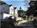
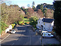

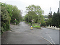


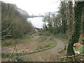
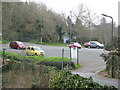

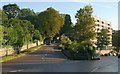

100 photos from this area
Area Information
Key information about the TQ1 2QP including its size, population, and administrative classification.
- Area Type
- Postcode
- Area Size
- 1.9 hectares
- Population
- 1487
- Population Density
- 891 people/km²
House Prices in TQ1 2QP
17
Properties
£383,500
Average Sold Price
£113,000
Lowest Price
£550,000
Highest Price
Showing 17 properties
| Address | Type | Beds | Baths | Last Sale Price | Last Sale Date | |
|---|---|---|---|---|---|---|
| 10 Ansteys Close, Wellswood, Torquay, TQ1 2QP | Terraced | 3 | 2 | £470,000 | May 2025 | |
| 12 Ansteys Close, Wellswood, Torquay, TQ1 2QP | Terraced | 3 | 1 | £370,000 | Oct 2024 | |
| 14 Ansteys Close, Wellswood, Torquay, TQ1 2QP | Terraced | 3 | 1 | £499,000 | Jul 2023 | |
| 19 Ansteys Close, Wellswood, Torquay, TQ1 2QP | house | 3 | - | £475,000 | Jun 2021 | |
| 2 Ansteys Close, Wellswood, Torquay, TQ1 2QP | Detached | 3 | 3 | £550,000 | Feb 2021 | |
| 9 Ansteys Close, Wellswood, Torquay, TQ1 2QP | Detached | 3 | 1 | £387,500 | Jan 2021 | |
| 11 Ansteys Close, Wellswood, Torquay, TQ1 2QP | Semi-detached | 3 | 1 | £400,000 | Feb 2020 | |
| 15 Ansteys Close, Wellswood, Torquay, TQ1 2QP | Terraced | 3 | 2 | £445,000 | Apr 2019 | |
| 5 Ansteys Close, Wellswood, Torquay, TQ1 2QP | Detached | 3 | 3 | £447,000 | Jan 2019 | |
| 8 Ansteys Close, Wellswood, Torquay, TQ1 2QP | Semi-detached | 3 | 1 | £310,000 | Jan 2019 |
Page 1 of 2
Energy Efficiency in TQ1 2QP
Amenities
Schools
| Rank | School | Type | Entry gender | Ages |
|---|
Explore more schools in this area
Go to Schools tabDemographics
Household Size
Two person
most common
Accommodation Type
Houses
most common
Tenure
86
majority
Ethnic Group
White
most common
Religion
N/A
most common
Household Composition
N/A
most common
Age
47
median
Elderly (65+ years)
most common
Household Deprivation
N/A
with no deprivation
NS-SEC
43
in Lower managerial occupations
Explore more demographic insights in this area
Go to Demographics tabPlanning
Planning Constraints
- Flood RiskPremium
- Ramsar Wetland SitesPremium
- Area of Outstanding Natural BeautyPremium
- Protected Nature ReservePremium
- Protected WoodlandPremium