Area Overview for Taynton
Photos of Taynton


Area Information
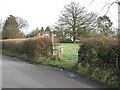
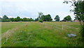
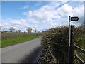
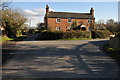
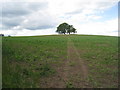
Living in Taynton means settling into a small, dispersed rural farming community situated in West Oxfordshire. The civil parish covers an area of 10.3 km² and sits approximately 1.5 miles northwest of Burford. You will find the village positioned on Coombe Brook, a tributary of the River Windrush, with the River Windrush forming its southern boundary and Gloucestershire lying to the west. This location places the parish within the Cotswolds Area of Outstanding Natural Beauty, though the land itself is not designated as an AONB. Your daily life is framed by visual containment from surrounding gentle slopes and trees, offering a tranquil character distinct from busier market towns. The population recently recorded was 108 people in 2001, indicating a very small community where residents know one another. The village is bounded north by Coombe Brook and Hazelden Brook, creating a distinctive landscape scattered with 17th and 18th-century limestone houses. Homes in Taynton often feature winding lanes and are surrounded by four large farms, including Lower Farm, Manor Farm, and Upper Farm. This setting provides a quiet retreat for those seeking a rural lifestyle close to historical sites like Magdalen Bridge.
- Area Type
- Parish
- Area Size
- 10.3 km²
- Population
- Not available
- Population Density
- Not available
Demographics
The community in Taynton is defined by a mature population, with a median age of 70 years. You are most likely to encounter residents in the total age range, suggesting a demographic skewed towards older adults. Home ownership stands at 83 per cent, reflecting a neighbourhood where families have invested in their own properties for generations. The high ownership rate suggests fewer private rentals compared to urban centres. Accommodation types and household composition data indicate a traditional structure typical of established rural parishes. There is no data provided on specific ethnic groups or religious breakdowns for Taynton, so the community appears culturally homogeneous based on available records. The 17th and 18th-century limestone cottages scattered along the lanes fit the profile of a settled population with deep local roots. This demographic makes the area attractive to retirees seeking a quiet life or potentially downsizers. With an ageing population, local services may remain limited to what is essential for daily needs. The stark median age of 70 contrasts with younger labour hubs, meaning the social life revolves around the village centre and church events rather than nightlife. If you are considering homes in Taynton, expect to join a community where stability and tradition define daily interactions.
Household Size
Accommodation Type
Tenure
Ethnic Group
Religion
Household Composition
Age
Household Deprivation
NS-SEC
Explore more demographic insights in this area
Go to Demographics tabPlanning
Planning Constraints
- Flood RiskPremium
- Ramsar Wetland SitesPremium
- Area of Outstanding Natural BeautyPremium
- Protected Nature ReservePremium
- Protected WoodlandPremium
- Crime RiskPremium