Area Overview for TA9 4HB
Photos of TA9 4HB
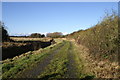
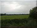
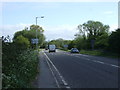
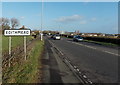
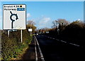
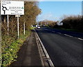
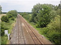
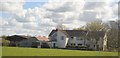
15 photos from this area
Area Information
Key information about the TA9 4HB including its size, population, and administrative classification.
- Area Type
- Postcode
- Area Size
- 48.4 hectares
- Population
- 1767
- Population Density
- 87 people/km²
House Prices in TA9 4HB
23
Properties
£291,731
Average Sold Price
£75,500
Lowest Price
£485,000
Highest Price
Showing 23 properties
| Address | Type | Beds | Baths | Last Sale Price | Last Sale Date | |
|---|---|---|---|---|---|---|
| Tryfan, Edithmead Lane, Edithmead, Highbridge, TA9 4HB | Semi-detached | 3 | 1 | £300,000 | Apr 2024 | |
| Kanga, Edithmead Lane, Edithmead, Highbridge, TA9 4HB | Semi-detached | 3 | 3 | £321,000 | Dec 2022 | |
| Grey Timbers, Edithmead Lane, Edithmead, Highbridge, TA9 4HB | Bungalow | - | - | £485,000 | Sep 2019 | |
| Orchard Leigh, Edithmead Lane, Edithmead, Highbridge, TA9 4HB | house | - | - | £370,000 | Feb 2019 | |
| Magpie Cottage, Edithmead Lane, Edithmead, Highbridge, TA9 4HB | house | - | - | £330,000 | Jul 2018 | |
| The Willows, Edithmead Lane, Edithmead, Highbridge, TA9 4HB | Detached | 4 | - | £400,000 | Aug 2015 | |
| Mayfields, Edithmead Lane, Edithmead, Highbridge, TA9 4HB | Detached | 3 | 3 | £280,000 | May 2015 | |
| Castanea, Edithmead Lane, Edithmead, Highbridge, TA9 4HB | Bungalow | 3 | - | £226,000 | Jun 2014 | |
| Cloverdale, Edithmead Lane, Edithmead, Highbridge, TA9 4HB | Detached | - | - | £275,000 | Nov 2012 | |
| Edith Cottage, Edithmead Lane, Edithmead, Highbridge, TA9 4HB | Detached | - | - | £285,000 | Jul 2008 |
Page 1 of 3
Energy Efficiency in TA9 4HB
Amenities
Schools
| Rank | School | Type | Entry gender | Ages |
|---|
Explore more schools in this area
Go to Schools tabDemographics
Household Size
Two person
most common
Accommodation Type
Houses
most common
Tenure
86
majority
Ethnic Group
White
most common
Religion
N/A
most common
Household Composition
N/A
most common
Age
47
median
Adults (30-64 years)
most common
Household Deprivation
N/A
with no deprivation
NS-SEC
36
in Lower managerial occupations
Explore more demographic insights in this area
Go to Demographics tabPlanning
Planning Constraints
- Flood RiskPremium
- Ramsar Wetland SitesPremium
- Area of Outstanding Natural BeautyPremium
- Protected Nature ReservePremium
- Protected WoodlandPremium