Area Overview for TA9 4DB
Photos of TA9 4DB

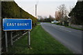


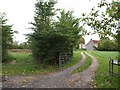
27 photos from this area
Area Information
Key information about the TA9 4DB including its size, population, and administrative classification.
- Area Type
- Postcode
- Area Size
- 27.3 hectares
- Population
- 2328
- Population Density
- 96 people/km²
House Prices in TA9 4DB
22
Properties
£334,838
Average Sold Price
£120,000
Lowest Price
£1,130,000
Highest Price
Showing 22 properties
| Address | Type | Beds | Baths | Last Sale Price | Last Sale Date | |
|---|---|---|---|---|---|---|
| Scots Lawn, Brent Road, East Brent, Highbridge, TA9 4DB | Detached | - | - | £1,130,000 | Jul 2023 | |
| Niagara, Brent Road, East Brent, Highbridge, TA9 4DB | Bungalow | - | - | £415,000 | Sep 2022 | |
| Summerhaze, Brent Road, East Brent, Highbridge, TA9 4DB | Bungalow | 3 | - | £344,000 | Dec 2019 | |
| Rowan House, Brent Road, East Brent, Highbridge, TA9 4DB | Semi-detached | 3 | 1 | £290,950 | Dec 2019 | |
| Elmcott, Brent Road, East Brent, Highbridge, TA9 4DB | house | - | - | £525,000 | Nov 2018 | |
| Tanglewood, Brent Road, East Brent, Highbridge, TA9 4DB | Detached | 4 | - | £370,000 | Oct 2018 | |
| Norbury, Brent Road, East Brent, Highbridge, TA9 4DB | Bungalow | 3 | - | £317,000 | Jul 2016 | |
| The White House, Brent Road, East Brent, Highbridge, TA9 4DB | Detached | 4 | 2 | £322,500 | Feb 2010 | |
| Wayfarers, Brent Road, East Brent, Highbridge, TA9 4DB | Detached | - | - | £250,000 | Oct 2008 | |
| Hillmead, Brent Road, East Brent, Highbridge, TA9 4DB | Semi-detached | - | - | £120,000 | Jan 2001 |
Page 1 of 3
Energy Efficiency in TA9 4DB
Amenities
Schools
| Rank | School | Type | Entry gender | Ages |
|---|
Explore more schools in this area
Go to Schools tabDemographics
Household Size
Two person
most common
Accommodation Type
Houses
most common
Tenure
81
majority
Ethnic Group
White
most common
Religion
N/A
most common
Household Composition
N/A
most common
Age
47
median
Adults (30-64 years)
most common
Household Deprivation
N/A
with no deprivation
NS-SEC
37
in Lower managerial occupations
Explore more demographic insights in this area
Go to Demographics tabPlanning
Planning Constraints
- Flood RiskPremium
- Ramsar Wetland SitesPremium
- Area of Outstanding Natural BeautyPremium
- Protected Nature ReservePremium
- Protected WoodlandPremium