Area Overview for TA9 3DN
Photos of TA9 3DN
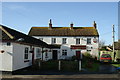
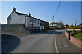


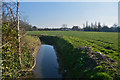
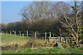


35 photos from this area
Area Information
Key information about the TA9 3DN including its size, population, and administrative classification.
- Area Type
- Postcode
- Area Size
- 8590 m²
- Population
- 2243
- Population Density
- 128 people/km²
House Prices in TA9 3DN
21
Properties
£210,054
Average Sold Price
£48,500
Lowest Price
£488,000
Highest Price
Showing 21 properties
| Address | Type | Beds | Baths | Last Sale Price | Last Sale Date | |
|---|---|---|---|---|---|---|
| 10 Main Road, West Huntspill, Highbridge, TA9 3DN | house | - | - | £300,000 | Jan 2024 | |
| 30 Main Road, West Huntspill, Highbridge, TA9 3DN | house | - | - | £270,000 | Jun 2021 | |
| 6 Main Road, West Huntspill, Highbridge, TA9 3DN | house | 3 | - | £155,000 | Apr 2020 | |
| 18 Main Road, West Huntspill, Highbridge, TA9 3DN | house | - | - | £235,000 | Jun 2018 | |
| 20 Main Road, West Huntspill, Highbridge, TA9 3DN | Bungalow | - | - | £290,000 | Jan 2017 | |
| 36 Main Road, West Huntspill, Highbridge, TA9 3DN | Detached | 5 | 3 | £488,000 | Apr 2016 | |
| 4 Main Road, West Huntspill, Highbridge, TA9 3DN | house | - | - | £130,000 | Feb 2016 | |
| 22 Main Road, West Huntspill, Highbridge, TA9 3DN | Detached | 3 | 2 | £190,000 | Jan 2016 | |
| 12 Main Road, West Huntspill, Highbridge, TA9 3DN | house | - | - | £189,650 | Mar 2015 | |
| 24 Main Road, West Huntspill, Highbridge, TA9 3DN | house | - | - | £160,000 | Jul 2009 |
Page 1 of 3
Energy Efficiency in TA9 3DN
Amenities
Schools
| Rank | School | Type | Entry gender | Ages |
|---|
Explore more schools in this area
Go to Schools tabDemographics
Household Size
Two person
most common
Accommodation Type
Houses
most common
Tenure
77
majority
Ethnic Group
White
most common
Religion
N/A
most common
Household Composition
N/A
most common
Age
47
median
Adults (30-64 years)
most common
Household Deprivation
N/A
with no deprivation
NS-SEC
25
in Lower managerial occupations
Explore more demographic insights in this area
Go to Demographics tabPlanning
Planning Constraints
- Flood RiskPremium
- Ramsar Wetland SitesPremium
- Area of Outstanding Natural BeautyPremium
- Protected Nature ReservePremium
- Protected WoodlandPremium