Area Overview for TA8 2SE
Photos of TA8 2SE

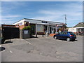
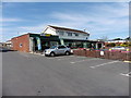
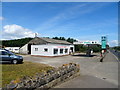
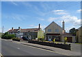


38 photos from this area
Area Information
Key information about the TA8 2SE including its size, population, and administrative classification.
- Area Type
- Postcode
- Area Size
- 75.3 hectares
- Population
- 2250
- Population Density
- 155 people/km²
House Prices in TA8 2SE
66
Properties
£265,474
Average Sold Price
£50,000
Lowest Price
£600,000
Highest Price
Showing 66 properties
| Address | Type | Beds | Baths | Last Sale Price | Last Sale Date | |
|---|---|---|---|---|---|---|
| Lynwood, Grass Road, Brean, Burnham On Sea, TA8 2SE | Bungalow | - | - | £369,950 | Feb 2025 | |
| The Dingle, Grass Road, Brean, Burnham On Sea, TA8 2SE | Bungalow | 2 | 1 | £375,000 | Oct 2022 | |
| Sacred Spirit, South Road, Brean, Burnham On Sea, TA8 2SE | Bungalow | - | - | £300,000 | Mar 2021 | |
| The Sands, Grass Road, Brean, Burnham On Sea, TA8 2SE | Bungalow | 3 | 2 | £426,000 | Mar 2021 | |
| Sea Mist, Grass Road, Brean, Burnham On Sea, TA8 2SE | Detached | - | - | £115,050 | Jan 2021 | |
| Sunset View, South Road, Brean, Burnham On Sea, TA8 2SE | Semi-detached | 3 | - | £600,000 | Aug 2020 | |
| Sandhills, South Road, Brean, Burnham On Sea, TA8 2SE | Bungalow | - | - | £250,000 | Aug 2017 | |
| Tangle Wood, Grass Road, Brean, Burnham On Sea, TA8 2SE | Bungalow | 3 | 2 | £420,000 | May 2017 | |
| Sweet Retreat, Grass Road, Brean, Burnham On Sea, TA8 2SE | Bungalow | 5 | 3 | £399,950 | Aug 2016 | |
| Sandyvale, Grass Road, Brean, Burnham On Sea, TA8 2SE | Detached | 3 | 2 | £245,000 | May 2014 |
Page 1 of 7
Energy Efficiency in TA8 2SE
Amenities
Schools
| Rank | School | Type | Entry gender | Ages |
|---|
Explore more schools in this area
Go to Schools tabDemographics
Household Size
Two person
most common
Accommodation Type
Houses
most common
Tenure
79
majority
Ethnic Group
White
most common
Religion
N/A
most common
Household Composition
N/A
most common
Age
47
median
Adults (30-64 years)
most common
Household Deprivation
N/A
with no deprivation
NS-SEC
25
in Lower managerial occupations
Explore more demographic insights in this area
Go to Demographics tabPlanning
Planning Constraints
- Flood RiskPremium
- Ramsar Wetland SitesPremium
- Area of Outstanding Natural BeautyPremium
- Protected Nature ReservePremium
- Protected WoodlandPremium