Area Overview for TA8 2RR
Photos of TA8 2RR


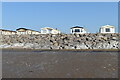
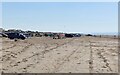
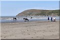
33 photos from this area
Area Information
Key information about the TA8 2RR including its size, population, and administrative classification.
- Area Type
- Postcode
- Area Size
- 3.4 km²
- Population
- 2250
- Population Density
- 155 people/km²
House Prices in TA8 2RR
41
Properties
£315,666
Average Sold Price
£84,500
Lowest Price
£550,000
Highest Price
Showing 41 properties
| Address | Type | Beds | Baths | Last Sale Price | Last Sale Date | |
|---|---|---|---|---|---|---|
| Pendil And Attivo, Warren Road, Brean, Burnham On Sea, TA8 2RR | Semi-detached | 2 | 2 | £550,000 | Oct 2023 | |
| The Highway, Warren Road, Brean, Burnham On Sea, TA8 2RR | house | - | - | £450,000 | Dec 2020 | |
| Sandmore, Warren Road, Brean, Burnham On Sea, TA8 2RR | Detached | - | - | £475,000 | Jul 2020 | |
| Burrows, Warren Road, Brean, Burnham On Sea, TA8 2RR | Bungalow | - | - | £347,500 | Nov 2019 | |
| Quantock View, Warren Road, Brean, Burnham On Sea, TA8 2RR | Bungalow | 3 | - | £360,000 | May 2018 | |
| Sea Holm, Warren Road, Brean, Burnham On Sea, TA8 2RR | Semi-detached | 4 | 2 | £317,500 | Feb 2017 | |
| The Boat House, Warren Road, Brean, Burnham On Sea, TA8 2RR | house | - | - | £395,000 | Apr 2015 | |
| Westholm, Warren Road, Brean, Burnham On Sea, TA8 2RR | Detached | 4 | - | £357,500 | Jul 2013 | |
| The Beach House, Warren Road, Brean, Burnham On Sea, TA8 2RR | Bungalow | 4 | - | £305,000 | Oct 2012 | |
| Cardon, Warren Road, Brean, Burnham On Sea, TA8 2RR | Bungalow | 4 | - | £360,000 | Sep 2012 |
Page 1 of 5
Energy Efficiency in TA8 2RR
Amenities
Schools
| Rank | School | Type | Entry gender | Ages |
|---|
Explore more schools in this area
Go to Schools tabDemographics
Household Size
Two person
most common
Accommodation Type
Houses
most common
Tenure
79
majority
Ethnic Group
White
most common
Religion
N/A
most common
Household Composition
N/A
most common
Age
47
median
Adults (30-64 years)
most common
Household Deprivation
N/A
with no deprivation
NS-SEC
25
in Lower managerial occupations
Explore more demographic insights in this area
Go to Demographics tabPlanning
Planning Constraints
- Flood RiskPremium
- Ramsar Wetland SitesPremium
- Area of Outstanding Natural BeautyPremium
- Protected Nature ReservePremium
- Protected WoodlandPremium