Area Overview for TA8 2PY
Photos of TA8 2PY


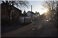
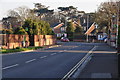
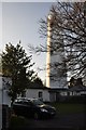
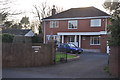
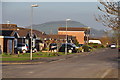
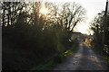
90 photos from this area
Area Information
Key information about the TA8 2PY including its size, population, and administrative classification.
- Area Type
- Postcode
- Area Size
- 2.6 hectares
- Population
- 1466
- Population Density
- 2151 people/km²
House Prices in TA8 2PY
38
Properties
£289,633
Average Sold Price
£85,500
Lowest Price
£535,000
Highest Price
Showing 38 properties
| Address | Type | Beds | Baths | Last Sale Price | Last Sale Date | |
|---|---|---|---|---|---|---|
| 2 Brambles Road, Burnham On Sea, TA8 2PY | Detached | 3 | 2 | £505,000 | Aug 2025 | |
| 43 Brambles Road, Burnham On Sea, TA8 2PY | Retail | 4 | - | £535,000 | Jul 2022 | |
| 39 Brambles Road, Burnham On Sea, TA8 2PY | Detached | 3 | 1 | £285,000 | Jun 2022 | |
| 30 Brambles Road, Burnham On Sea, TA8 2PY | house | - | - | £280,000 | Jul 2021 | |
| 20 Brambles Road, Burnham On Sea, TA8 2PY | Bungalow | 2 | 1 | £335,000 | Feb 2021 | |
| 9 Brambles Road, Burnham On Sea, TA8 2PY | house | - | - | £292,500 | Dec 2020 | |
| 26 Brambles Road, Burnham On Sea, TA8 2PY | Semi-detached | 3 | 1 | £316,000 | Oct 2020 | |
| 11 Brambles Road, Burnham On Sea, TA8 2PY | Bungalow | - | - | £260,000 | Mar 2020 | |
| 45 Brambles Road, Burnham On Sea, TA8 2PY | Detached | 5 | 4 | £400,000 | Jul 2018 | |
| 41 Brambles Road, Burnham On Sea, TA8 2PY | house | - | - | £415,000 | Jun 2018 |
Page 1 of 4
Energy Efficiency in TA8 2PY
Amenities
Schools
| Rank | School | Type | Entry gender | Ages |
|---|
Explore more schools in this area
Go to Schools tabDemographics
Household Size
Two person
most common
Accommodation Type
Houses
most common
Tenure
86
majority
Ethnic Group
White
most common
Religion
N/A
most common
Household Composition
N/A
most common
Age
47
median
Elderly (65+ years)
most common
Household Deprivation
N/A
with no deprivation
NS-SEC
33
in Lower managerial occupations
Explore more demographic insights in this area
Go to Demographics tabPlanning
Planning Constraints
- Flood RiskPremium
- Ramsar Wetland SitesPremium
- Area of Outstanding Natural BeautyPremium
- Protected Nature ReservePremium
- Protected WoodlandPremium