Area Overview for TA8 2PS
Photos of TA8 2PS


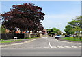
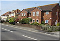
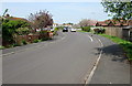
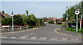

32 photos from this area
Area Information
Key information about the TA8 2PS including its size, population, and administrative classification.
- Area Type
- Postcode
- Area Size
- 1.2 hectares
- Population
- 1610
- Population Density
- 864 people/km²
House Prices in TA8 2PS
22
Properties
£222,950
Average Sold Price
£124,000
Lowest Price
£322,000
Highest Price
Showing 22 properties
| Address | Type | Beds | Baths | Last Sale Price | Last Sale Date | |
|---|---|---|---|---|---|---|
| 38 Saxondale Avenue, Burnham On Sea, TA8 2PS | Bungalow | 3 | 1 | £322,000 | Aug 2025 | |
| 40 Saxondale Avenue, Burnham On Sea, TA8 2PS | Bungalow | 2 | 1 | £315,000 | Oct 2023 | |
| 42 Saxondale Avenue, Burnham On Sea, TA8 2PS | Bungalow | - | - | £300,000 | Jan 2023 | |
| 48 Saxondale Avenue, Burnham On Sea, TA8 2PS | Bungalow | 2 | 1 | £295,000 | Nov 2022 | |
| 41 Saxondale Avenue, Burnham On Sea, TA8 2PS | Bungalow | - | - | £285,000 | Dec 2021 | |
| 34 Saxondale Avenue, Burnham On Sea, TA8 2PS | Semi-detached | 3 | 1 | £285,000 | Nov 2021 | |
| 47 Saxondale Avenue, Burnham On Sea, TA8 2PS | Bungalow | - | 1 | £240,000 | Sep 2020 | |
| 44 Saxondale Avenue, Burnham On Sea, TA8 2PS | Semi-detached | 2 | 1 | £185,000 | Jul 2017 | |
| 30 Saxondale Avenue, Burnham On Sea, TA8 2PS | Bungalow | - | - | £205,000 | Apr 2017 | |
| 49 Saxondale Avenue, Burnham On Sea, TA8 2PS | Bungalow | 3 | - | £255,000 | Feb 2016 |
Page 1 of 3
Energy Efficiency in TA8 2PS
Amenities
Schools
| Rank | School | Type | Entry gender | Ages |
|---|
Explore more schools in this area
Go to Schools tabDemographics
Household Size
Two person
most common
Accommodation Type
Houses
most common
Tenure
90
majority
Ethnic Group
White
most common
Religion
N/A
most common
Household Composition
N/A
most common
Age
47
median
Elderly (65+ years)
most common
Household Deprivation
N/A
with no deprivation
NS-SEC
34
in Lower managerial occupations
Explore more demographic insights in this area
Go to Demographics tabPlanning
Planning Constraints
- Flood RiskPremium
- Ramsar Wetland SitesPremium
- Area of Outstanding Natural BeautyPremium
- Protected Nature ReservePremium
- Protected WoodlandPremium