Area Overview for TA8 2NJ
Photos of TA8 2NJ
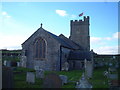
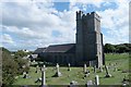


68 photos from this area
Area Information
Key information about the TA8 2NJ including its size, population, and administrative classification.
- Area Type
- Postcode
- Area Size
- 2.0 hectares
- Population
- 2250
- Population Density
- 155 people/km²
House Prices in TA8 2NJ
16
Properties
£282,929
Average Sold Price
£85,000
Lowest Price
£482,500
Highest Price
Showing 16 properties
| Address | Type | Beds | Baths | Last Sale Price | Last Sale Date | |
|---|---|---|---|---|---|---|
| 47 Parsonage Road, Berrow, Burnham On Sea, TA8 2NJ | Detached | 5 | 2 | £482,500 | Jun 2025 | |
| 35 Parsonage Road, Berrow, Burnham On Sea, TA8 2NJ | Bungalow | 4 | - | £410,000 | Mar 2021 | |
| 45 Parsonage Road, Berrow, Burnham On Sea, TA8 2NJ | Bungalow | - | - | £349,000 | Mar 2021 | |
| 33 Parsonage Road, Berrow, Burnham On Sea, TA8 2NJ | house | 5 | - | £385,000 | Sep 2013 | |
| 49 Parsonage Road, Berrow, Burnham On Sea, TA8 2NJ | Bungalow | - | - | £144,000 | Jul 2003 | |
| 27 Parsonage Road, Berrow, Burnham On Sea, TA8 2NJ | Detached | - | - | £125,000 | May 1999 | |
| 41 Parsonage Road, Berrow, Burnham On Sea, TA8 2NJ | Detached | - | - | £85,000 | May 1999 | |
| The Glebe, 16A Parsonage Road, Berrow, Burnham On Sea, TA8 2NJ | Retail | 5 | 2 | - | - | |
| Northcott, 18 Parsonage Road, Berrow, Burnham On Sea, TA8 2NJ | Detached | 4 | 3 | - | - | |
| 23 Parsonage Road, Berrow, Burnham On Sea, TA8 2NJ | Semi-detached | - | - | - | - |
Page 1 of 2
Energy Efficiency in TA8 2NJ
Amenities
Schools
| Rank | School | Type | Entry gender | Ages |
|---|
Explore more schools in this area
Go to Schools tabDemographics
Household Size
Two person
most common
Accommodation Type
Houses
most common
Tenure
79
majority
Ethnic Group
White
most common
Religion
N/A
most common
Household Composition
N/A
most common
Age
47
median
Adults (30-64 years)
most common
Household Deprivation
N/A
with no deprivation
NS-SEC
25
in Lower managerial occupations
Explore more demographic insights in this area
Go to Demographics tabPlanning
Planning Constraints
- Flood RiskPremium
- Ramsar Wetland SitesPremium
- Area of Outstanding Natural BeautyPremium
- Protected Nature ReservePremium
- Protected WoodlandPremium