Area Overview for TA8 2LD
Photos of TA8 2LD
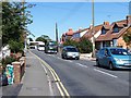
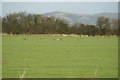
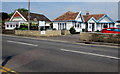
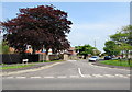
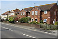
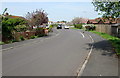
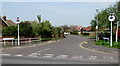
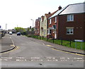
32 photos from this area
Area Information
Key information about the TA8 2LD including its size, population, and administrative classification.
- Area Type
- Postcode
- Area Size
- 1.0 hectares
- Population
- 1610
- Population Density
- 864 people/km²
House Prices in TA8 2LD
21
Properties
£227,269
Average Sold Price
£54,000
Lowest Price
£366,000
Highest Price
Showing 21 properties
| Address | Type | Beds | Baths | Last Sale Price | Last Sale Date | |
|---|---|---|---|---|---|---|
| 20 Ash Tree Road, Burnham On Sea, TA8 2LD | Bungalow | - | - | £366,000 | Jan 2023 | |
| 34 Ash Tree Road, Burnham On Sea, TA8 2LD | Semi-detached | 3 | 1 | £325,000 | Nov 2022 | |
| 11 Ash Tree Road, Burnham On Sea, TA8 2LD | Bungalow | 2 | 1 | £265,000 | May 2022 | |
| 28 Ash Tree Road, Burnham On Sea, TA8 2LD | house | - | - | £290,000 | Aug 2021 | |
| 21 Ash Tree Road, Burnham On Sea, TA8 2LD | Semi-detached | 2 | - | £250,000 | Oct 2020 | |
| 15 Ash Tree Road, Burnham On Sea, TA8 2LD | Bungalow | - | - | £208,000 | Jul 2020 | |
| 26 Ash Tree Road, Burnham On Sea, TA8 2LD | house | 3 | - | £248,000 | Aug 2018 | |
| 27 Ash Tree Road, Burnham On Sea, TA8 2LD | Semi-detached | 2 | - | £242,000 | Aug 2018 | |
| 24 Ash Tree Road, Burnham On Sea, TA8 2LD | Bungalow | 3 | 1 | £277,500 | Apr 2018 | |
| 25 Ash Tree Road, Burnham On Sea, TA8 2LD | Bungalow | - | - | £190,000 | Mar 2016 |
Page 1 of 3
Energy Efficiency in TA8 2LD
Amenities
Schools
| Rank | School | Type | Entry gender | Ages |
|---|
Explore more schools in this area
Go to Schools tabDemographics
Household Size
Two person
most common
Accommodation Type
Houses
most common
Tenure
90
majority
Ethnic Group
White
most common
Religion
N/A
most common
Household Composition
N/A
most common
Age
47
median
Elderly (65+ years)
most common
Household Deprivation
N/A
with no deprivation
NS-SEC
34
in Lower managerial occupations
Explore more demographic insights in this area
Go to Demographics tabPlanning
Planning Constraints
- Flood RiskPremium
- Ramsar Wetland SitesPremium
- Area of Outstanding Natural BeautyPremium
- Protected Nature ReservePremium
- Protected WoodlandPremium