Area Overview for TA8 2EZ
Photos of TA8 2EZ
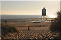
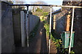
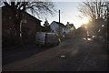
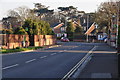
90 photos from this area
Area Information
Key information about the TA8 2EZ including its size, population, and administrative classification.
- Area Type
- Postcode
- Area Size
- 7.8 hectares
- Population
- 1564
- Population Density
- 3252 people/km²
House Prices in TA8 2EZ
55
Properties
£316,433
Average Sold Price
£75,250
Lowest Price
£572,500
Highest Price
Showing 55 properties
| Address | Type | Beds | Baths | Last Sale Price | Last Sale Date | |
|---|---|---|---|---|---|---|
| 31 Berrow Road, Burnham On Sea, TA8 2EZ | Bungalow | 1 | 1 | £180,000 | Jan 2022 | |
| 39 Berrow Road, Burnham On Sea, TA8 2EZ | house | - | - | £365,000 | Jun 2021 | |
| 35 Berrow Road, Burnham On Sea, TA8 2EZ | house | 6 | 2 | £485,000 | Sep 2019 | |
| 29 Berrow Road, Burnham On Sea, TA8 2EZ | Detached | 11 | 10 | £530,000 | May 2013 | |
| 33 Berrow Road, Burnham On Sea, TA8 2EZ | Semi-detached | 5 | - | £308,000 | Jun 2011 | |
| Pinecourt, Berrow Road, Burnham On Sea, TA8 2EZ | Bungalow | - | - | £249,950 | May 2010 | |
| 43 Berrow Road, Burnham On Sea, TA8 2EZ | Detached | - | - | £310,000 | Nov 2007 | |
| Casa Solana, Berrow Road, Burnham On Sea, TA8 2EZ | Detached | 4 | 2 | £420,000 | Jul 2007 | |
| Landan House, Berrow Road, Burnham On Sea, TA8 2EZ | Detached | - | - | £572,500 | Aug 2006 | |
| 62 Berrow Road, Burnham On Sea, TA8 2EZ | Detached | - | - | £157,500 | May 2000 |
Page 1 of 6
Energy Efficiency in TA8 2EZ
Amenities
Schools
| Rank | School | Type | Entry gender | Ages |
|---|
Explore more schools in this area
Go to Schools tabDemographics
Household Size
One person
most common
Accommodation Type
Flats
most common
Tenure
53
majority
Ethnic Group
White
most common
Religion
N/A
most common
Household Composition
N/A
most common
Age
47
median
Adults (30-64 years)
most common
Household Deprivation
N/A
with no deprivation
NS-SEC
25
in Lower managerial occupations
Explore more demographic insights in this area
Go to Demographics tabPlanning
Planning Constraints
- Flood RiskPremium
- Ramsar Wetland SitesPremium
- Area of Outstanding Natural BeautyPremium
- Protected Nature ReservePremium
- Protected WoodlandPremium