Area Overview for TA7 9BH
Photos of TA7 9BH
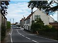


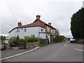
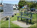
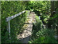
35 photos from this area
Area Information
Key information about the TA7 9BH including its size, population, and administrative classification.
- Area Type
- Postcode
- Area Size
- 83.1 hectares
- Population
- 2031
- Population Density
- 60 people/km²
House Prices in TA7 9BH
21
Properties
£351,889
Average Sold Price
£135,000
Lowest Price
£875,000
Highest Price
Showing 21 properties
| Address | Type | Beds | Baths | Last Sale Price | Last Sale Date | |
|---|---|---|---|---|---|---|
| 13 Taunton Road, Ashcott, Bridgwater, TA7 9BH | house | - | - | £640,000 | Jun 2021 | |
| 4 Taunton Road, Ashcott, Bridgwater, TA7 9BH | house | 3 | 2 | £195,500 | Aug 2016 | |
| Norvale, Taunton Road, Ashcott, Bridgwater, TA7 9BH | house | - | - | £282,000 | Feb 2016 | |
| 6 Taunton Road, Ashcott, Bridgwater, TA7 9BH | Semi-detached | 3 | - | £182,500 | Apr 2014 | |
| 10 Taunton Road, Ashcott, Bridgwater, TA7 9BH | Semi-detached | 3 | 1 | £315,000 | Dec 2007 | |
| Woodside, Combe Hill Lane, Ashcott, Bridgwater, TA7 9BH | Detached | - | - | £405,000 | Jun 2007 | |
| Bluff View, Combe Hill Lane, Ashcott, Bridgwater, TA7 9BH | Land | - | - | £875,000 | Jul 2006 | |
| 8 Taunton Road, Ashcott, Bridgwater, TA7 9BH | house | - | - | £135,000 | Nov 2002 | |
| 1 Taunton Road, Ashcott, Bridgwater, TA7 9BH | Bungalow | 4 | 2 | £137,000 | May 1996 | |
| 12 Taunton Road, Ashcott, Bridgwater, TA7 9BH | Detached | 4 | 2 | - | - |
Page 1 of 3
Energy Efficiency in TA7 9BH
Amenities
Schools
| Rank | School | Type | Entry gender | Ages |
|---|
Explore more schools in this area
Go to Schools tabDemographics
Household Size
Two person
most common
Accommodation Type
Houses
most common
Tenure
82
majority
Ethnic Group
White
most common
Religion
N/A
most common
Household Composition
N/A
most common
Age
47
median
Adults (30-64 years)
most common
Household Deprivation
N/A
with no deprivation
NS-SEC
37
in Lower managerial occupations
Explore more demographic insights in this area
Go to Demographics tabPlanning
Planning Constraints
- Flood RiskPremium
- Ramsar Wetland SitesPremium
- Area of Outstanding Natural BeautyPremium
- Protected Nature ReservePremium
- Protected WoodlandPremium