Area Overview for TA7 0JL
Photos of TA7 0JL
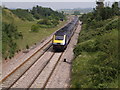
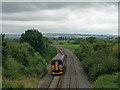
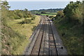
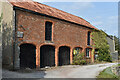
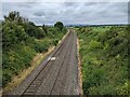
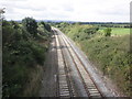
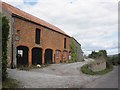
24 photos from this area
Area Information
Key information about the TA7 0JL including its size, population, and administrative classification.
- Area Type
- Postcode
- Area Size
- 1.5 km²
- Population
- 1534
- Population Density
- 73 people/km²
House Prices in TA7 0JL
30
Properties
£512,454
Average Sold Price
£131,500
Lowest Price
£2,035,540
Highest Price
Showing 30 properties
| Address | Type | Beds | Baths | Last Sale Price | Last Sale Date | |
|---|---|---|---|---|---|---|
| Walkers Farm, Bullplace Bridge Road, Stathe, Bridgwater, TA7 0JL | Detached | - | - | £2,035,540 | Nov 2020 | |
| Ludwells Cottage, Bullplace Bridge Road, Stathe, Bridgwater, TA7 0JL | Detached | 4 | 2 | £305,000 | May 2020 | |
| Witch Croft, Bullplace Bridge Road, Stathe, Bridgwater, TA7 0JL | house | - | - | £650,000 | Apr 2019 | |
| Sunnyside, Bullplace Bridge Road, Stathe, Bridgwater, TA7 0JL | house | 4 | - | £435,000 | Jul 2016 | |
| Stathe Court Farmhouse, Bullplace Bridge Road, Stathe, Bridgwater, TA7 0JL | Semi-detached | - | - | £334,950 | Feb 2012 | |
| Dairy House Barn, Bullplace Bridge Road, Stathe, Bridgwater, TA7 0JL | Detached | 5 | 3 | £395,000 | Apr 2011 | |
| New Corner House, Bullplace Bridge Road, Stathe, Bridgwater, TA7 0JL | Detached | - | - | £420,000 | Jul 2007 | |
| The Old Chapel, Bullplace Bridge Road, Stathe, Bridgwater, TA7 0JL | Detached | - | - | £320,000 | Jun 2007 | |
| Lammas Cottage, Bullplace Bridge Road, Stathe, Bridgwater, TA7 0JL | Detached | - | - | £360,000 | Nov 2002 | |
| Redlands, Bullplace Bridge Road, Stathe, Bridgwater, TA7 0JL | house | - | - | £131,500 | Apr 1999 |
Page 1 of 3
Energy Efficiency in TA7 0JL
Amenities
Schools
| Rank | School | Type | Entry gender | Ages |
|---|
Explore more schools in this area
Go to Schools tabDemographics
Household Size
Two person
most common
Accommodation Type
Houses
most common
Tenure
75
majority
Ethnic Group
White
most common
Religion
N/A
most common
Household Composition
N/A
most common
Age
47
median
Adults (30-64 years)
most common
Household Deprivation
N/A
with no deprivation
NS-SEC
39
in Lower managerial occupations
Explore more demographic insights in this area
Go to Demographics tabPlanning
Planning Constraints
- Flood RiskPremium
- Ramsar Wetland SitesPremium
- Area of Outstanding Natural BeautyPremium
- Protected Nature ReservePremium
- Protected WoodlandPremium