Area Overview for TA7 0BZ
Photos of TA7 0BZ
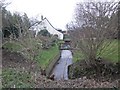
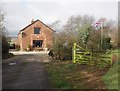

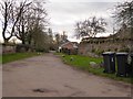
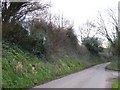
32 photos from this area
Area Information
Key information about the TA7 0BZ including its size, population, and administrative classification.
- Area Type
- Postcode
- Area Size
- 66.1 hectares
- Population
- 1234
- Population Density
- 61 people/km²
House Prices in TA7 0BZ
15
Properties
£406,000
Average Sold Price
£240,000
Lowest Price
£580,000
Highest Price
Showing 15 properties
| Address | Type | Beds | Baths | Last Sale Price | Last Sale Date | |
|---|---|---|---|---|---|---|
| Rydon Farm, West Newton Road, West Newton, Bridgwater, TA7 0BZ | house | 5 | - | £580,000 | Nov 2019 | |
| Rydon Cottage, West Newton Road, West Newton, Bridgwater, TA7 0BZ | Detached | 5 | 2 | £500,000 | Aug 2019 | |
| Old School House, West Newton Road, West Newton, Bridgwater, TA7 0BZ | house | 1 | - | £380,000 | Nov 2016 | |
| The Hollies, West Newton Road, West Newton, Bridgwater, TA7 0BZ | Detached | 4 | 2 | £330,000 | Jul 2010 | |
| 2, Manor Cottage, Primore Road, West Newton, Bridgwater, TA7 0BZ | house | - | - | £240,000 | Jul 2004 | |
| Battens Barton, Adsborough Lane, West Newton, Bridgwater, TA7 0BZ | Detached | - | - | - | - | |
| 1, Batten Villa, West Newton Road, West Newton, Bridgwater, TA7 0BZ | Semi-detached | - | - | - | - | |
| 2, Batten Villa, West Newton Road, West Newton, Bridgwater, TA7 0BZ | house | - | - | - | - | |
| The Cider House, West Newton Road, West Newton, Bridgwater, TA7 0BZ | Detached | - | - | - | - | |
| 1, Manor Cottage, Primore Road, West Newton, Bridgwater, TA7 0BZ | Semi-detached | - | - | - | - |
Page 1 of 2
Energy Efficiency in TA7 0BZ
Amenities
Schools
| Rank | School | Type | Entry gender | Ages |
|---|
Explore more schools in this area
Go to Schools tabDemographics
Household Size
Two person
most common
Accommodation Type
Houses
most common
Tenure
84
majority
Ethnic Group
White
most common
Religion
N/A
most common
Household Composition
N/A
most common
Age
47
median
Adults (30-64 years)
most common
Household Deprivation
N/A
with no deprivation
NS-SEC
34
in Lower managerial occupations
Explore more demographic insights in this area
Go to Demographics tabPlanning
Planning Constraints
- Flood RiskPremium
- Ramsar Wetland SitesPremium
- Area of Outstanding Natural BeautyPremium
- Protected Nature ReservePremium
- Protected WoodlandPremium