Area Overview for TA6 7JE
Photos of TA6 7JE

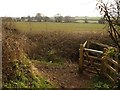
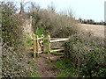
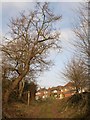
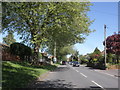


28 photos from this area
Area Information
Key information about the TA6 7JE including its size, population, and administrative classification.
- Area Type
- Postcode
- Area Size
- 5.4 hectares
- Population
- 2000
- Population Density
- 2789 people/km²
House Prices in TA6 7JE
23
Properties
£288,528
Average Sold Price
£89,000
Lowest Price
£530,000
Highest Price
Showing 23 properties
| Address | Type | Beds | Baths | Last Sale Price | Last Sale Date | |
|---|---|---|---|---|---|---|
| 76 Durleigh Road, Bridgwater, TA6 7JE | Detached | 3 | 2 | £530,000 | Dec 2025 | |
| 68 Durleigh Road, Bridgwater, TA6 7JE | Bungalow | 3 | 2 | £485,000 | Jun 2025 | |
| 103 Durleigh Road, Bridgwater, TA6 7JE | Bungalow | 2 | 2 | £400,000 | Apr 2024 | |
| 113 Durleigh Road, Bridgwater, TA6 7JE | Semi-detached | 4 | - | £415,000 | Jul 2023 | |
| 54 Durleigh Road, Bridgwater, TA6 7JE | house | - | - | £310,000 | Jun 2021 | |
| 58 Durleigh Road, Bridgwater, TA6 7JE | Bungalow | - | - | £355,000 | Oct 2020 | |
| 56 Durleigh Road, Bridgwater, TA6 7JE | Bungalow | 4 | 2 | £301,500 | Nov 2017 | |
| Durleigh Banks, 66 Durleigh Road, Bridgwater, TA6 7JE | Bungalow | 3 | - | £300,000 | Oct 2016 | |
| 78 Durleigh Road, Bridgwater, TA6 7JE | Detached | 4 | 2 | £270,000 | Mar 2015 | |
| 62 Durleigh Road, Bridgwater, TA6 7JE | Bungalow | 3 | - | £250,000 | Feb 2015 |
Page 1 of 3
Energy Efficiency in TA6 7JE
Amenities
Schools
| Rank | School | Type | Entry gender | Ages |
|---|
Explore more schools in this area
Go to Schools tabDemographics
Household Size
Family (3-5 people)
most common
Accommodation Type
Houses
most common
Tenure
85
majority
Ethnic Group
White
most common
Religion
N/A
most common
Household Composition
N/A
most common
Age
47
median
Adults (30-64 years)
most common
Household Deprivation
N/A
with no deprivation
NS-SEC
35
in Lower managerial occupations
Explore more demographic insights in this area
Go to Demographics tabPlanning
Planning Constraints
- Flood RiskPremium
- Ramsar Wetland SitesPremium
- Area of Outstanding Natural BeautyPremium
- Protected Nature ReservePremium
- Protected WoodlandPremium