Area Overview for TA6 6RN
Photos of TA6 6RN

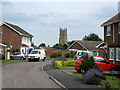

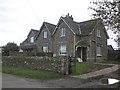
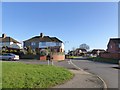
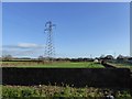


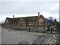
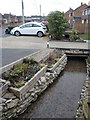
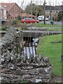
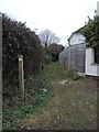
23 photos from this area
Area Information
Key information about the TA6 6RN including its size, population, and administrative classification.
- Area Type
- Postcode
- Area Size
- 1.3 hectares
- Population
- 1516
- Population Density
- 1449 people/km²
House Prices in TA6 6RN
30
Properties
£197,588
Average Sold Price
£49,000
Lowest Price
£330,000
Highest Price
Showing 30 properties
| Address | Type | Beds | Baths | Last Sale Price | Last Sale Date | |
|---|---|---|---|---|---|---|
| 45 Baymead Lane, North Petherton, Bridgwater, TA6 6RN | Semi-detached | 3 | 1 | £270,000 | Apr 2024 | |
| 63 Baymead Lane, North Petherton, Bridgwater, TA6 6RN | Retail | 3 | 1 | £290,000 | Apr 2022 | |
| 79 Baymead Lane, North Petherton, Bridgwater, TA6 6RN | house | - | - | £330,000 | Dec 2021 | |
| 112 Baymead Lane, North Petherton, Bridgwater, TA6 6RN | house | - | - | £285,000 | Oct 2021 | |
| 77 Baymead Lane, North Petherton, Bridgwater, TA6 6RN | house | - | - | £270,000 | Sep 2021 | |
| 75 Baymead Lane, North Petherton, Bridgwater, TA6 6RN | house | - | - | £265,000 | Sep 2021 | |
| 73 Baymead Lane, North Petherton, Bridgwater, TA6 6RN | house | - | - | £315,000 | Jul 2021 | |
| 71 Baymead Lane, North Petherton, Bridgwater, TA6 6RN | house | - | - | £220,000 | Jun 2021 | |
| 55 Baymead Lane, North Petherton, Bridgwater, TA6 6RN | house | - | - | £265,000 | Nov 2020 | |
| 67 Baymead Lane, North Petherton, Bridgwater, TA6 6RN | Detached | 3 | 1 | £265,000 | Dec 2019 |
Page 1 of 3
Energy Efficiency in TA6 6RN
Amenities
Schools
| Rank | School | Type | Entry gender | Ages |
|---|
Explore more schools in this area
Go to Schools tabDemographics
Household Size
Two person
most common
Accommodation Type
Houses
most common
Tenure
84
majority
Ethnic Group
White
most common
Religion
N/A
most common
Household Composition
N/A
most common
Age
47
median
Adults (30-64 years)
most common
Household Deprivation
N/A
with no deprivation
NS-SEC
32
in Lower managerial occupations
Explore more demographic insights in this area
Go to Demographics tabPlanning
Planning Constraints
- Flood RiskPremium
- Ramsar Wetland SitesPremium
- Area of Outstanding Natural BeautyPremium
- Protected Nature ReservePremium
- Protected WoodlandPremium