Area Overview for TA6 6LT
Photos of TA6 6LT
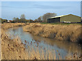
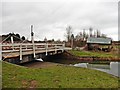

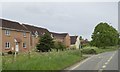
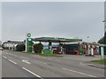

64 photos from this area
Area Information
Key information about the TA6 6LT including its size, population, and administrative classification.
- Area Type
- Postcode
- Area Size
- 1.1 hectares
- Population
- 1412
- Population Density
- 1053 people/km²
House Prices in TA6 6LT
17
Properties
£101,727
Average Sold Price
£32,500
Lowest Price
£215,000
Highest Price
Showing 17 properties
| Address | Type | Beds | Baths | Last Sale Price | Last Sale Date | |
|---|---|---|---|---|---|---|
| 4 Stock Moor Close, North Petherton, Bridgwater, TA6 6LT | house | - | - | £215,000 | Sep 2023 | |
| 3 Stock Moor Close, North Petherton, Bridgwater, TA6 6LT | house | - | - | £133,000 | Oct 2016 | |
| 12 Stock Moor Close, North Petherton, Bridgwater, TA6 6LT | Flat | - | - | £88,000 | Feb 2016 | |
| 18 Stock Moor Close, North Petherton, Bridgwater, TA6 6LT | house | - | - | £120,000 | Jun 2014 | |
| 10 Stock Moor Close, North Petherton, Bridgwater, TA6 6LT | Terraced | 2 | 1 | £118,500 | Feb 2011 | |
| 11 Stock Moor Close, North Petherton, Bridgwater, TA6 6LT | house | - | - | £124,500 | May 2010 | |
| 7 Stock Moor Close, North Petherton, Bridgwater, TA6 6LT | Terraced | - | - | £103,000 | Oct 2006 | |
| 5 Stock Moor Close, North Petherton, Bridgwater, TA6 6LT | house | 2 | - | £112,500 | Jun 2005 | |
| 8 Stock Moor Close, North Petherton, Bridgwater, TA6 6LT | Terraced | - | - | £38,500 | Jul 1999 | |
| 14 Stock Moor Close, North Petherton, Bridgwater, TA6 6LT | Flat | 1 | 1 | £33,500 | Jun 1997 |
Page 1 of 2
Energy Efficiency in TA6 6LT
Amenities
Schools
| Rank | School | Type | Entry gender | Ages |
|---|
Explore more schools in this area
Go to Schools tabDemographics
Household Size
Family (3-5 people)
most common
Accommodation Type
Houses
most common
Tenure
66
majority
Ethnic Group
White
most common
Religion
N/A
most common
Household Composition
N/A
most common
Age
47
median
Adults (30-64 years)
most common
Household Deprivation
N/A
with no deprivation
NS-SEC
26
in Lower managerial occupations
Explore more demographic insights in this area
Go to Demographics tabPlanning
Planning Constraints
- Flood RiskPremium
- Ramsar Wetland SitesPremium
- Area of Outstanding Natural BeautyPremium
- Protected Nature ReservePremium
- Protected WoodlandPremium