Area Overview for TA5 2DP
Photos of TA5 2DP
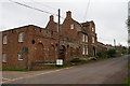
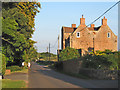
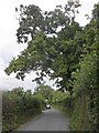
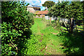
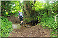
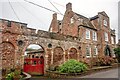
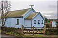
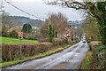
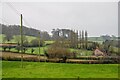
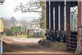
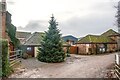
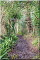
31 photos from this area
Area Information
Key information about the TA5 2DP including its size, population, and administrative classification.
- Area Type
- Postcode
- Area Size
- 16.4 hectares
- Population
- 1391
- Population Density
- 31 people/km²
House Prices in TA5 2DP
20
Properties
£369,911
Average Sold Price
£146,750
Lowest Price
£725,000
Highest Price
Showing 20 properties
| Address | Type | Beds | Baths | Last Sale Price | Last Sale Date | |
|---|---|---|---|---|---|---|
| Castlebrook, Enmore Road, Enmore, Bridgwater, TA5 2DP | house | 4 | - | £460,000 | Feb 2021 | |
| Laburnum Villa, Enmore Road, Enmore, Bridgwater, TA5 2DP | house | - | - | £725,000 | Jan 2021 | |
| Kilmorie, Enmore Road, Enmore, Bridgwater, TA5 2DP | Detached | 4 | 2 | £435,000 | Oct 2020 | |
| 3, School Cottages, Enmore Road, Enmore, Bridgwater, TA5 2DP | Semi-detached | 3 | 2 | £367,500 | Mar 2020 | |
| 1, School Cottages, Enmore Road, Enmore, Bridgwater, TA5 2DP | Semi-detached | 3 | 1 | £295,000 | Oct 2015 | |
| Churchview House, Enmore Road, Enmore, Bridgwater, TA5 2DP | Detached | - | - | £480,000 | Oct 2007 | |
| Jasmine Cottage, School Cottages, Enmore Road, Enmore, Bridgwater, TA5 2DP | house | - | - | £249,950 | May 2004 | |
| Harringay House, Enmore Road, Enmore, Bridgwater, TA5 2DP | Detached | 4 | 2 | £170,000 | Feb 1999 | |
| Hathersage, Enmore Road, Enmore, Bridgwater, TA5 2DP | house | - | - | £146,750 | Mar 1995 | |
| The Tythe Barn, Enmore Road, Enmore, Bridgwater, TA5 2DP | Detached | 4 | 1 | - | - |
Page 1 of 2
Energy Efficiency in TA5 2DP
Amenities
Schools
| Rank | School | Type | Entry gender | Ages |
|---|
Explore more schools in this area
Go to Schools tabDemographics
Household Size
Two person
most common
Accommodation Type
Houses
most common
Tenure
80
majority
Ethnic Group
White
most common
Religion
N/A
most common
Household Composition
N/A
most common
Age
47
median
Adults (30-64 years)
most common
Household Deprivation
N/A
with no deprivation
NS-SEC
39
in Lower managerial occupations
Explore more demographic insights in this area
Go to Demographics tabPlanning
Planning Constraints
- Flood RiskPremium
- Ramsar Wetland SitesPremium
- Area of Outstanding Natural BeautyPremium
- Protected Nature ReservePremium
- Protected WoodlandPremium