Area Overview for TA5 1JE
Photos of TA5 1JE

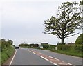

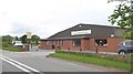
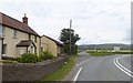
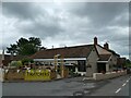
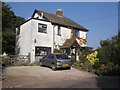
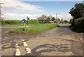
20 photos from this area
Area Information
Key information about the TA5 1JE including its size, population, and administrative classification.
- Area Type
- Postcode
- Area Size
- 47.3 hectares
- Population
- 1244
- Population Density
- 66 people/km²
House Prices in TA5 1JE
14
Properties
£371,673
Average Sold Price
£10,864
Lowest Price
£645,000
Highest Price
Showing 14 properties
| Address | Type | Beds | Baths | Last Sale Price | Last Sale Date | |
|---|---|---|---|---|---|---|
| Captains Cottage, Terrell Lane, Fiddington, Bridgwater, TA5 1JE | house | 4 | 2 | £645,000 | Oct 2023 | |
| Honeypots, Whitnell Lane, Fiddington, Bridgwater, TA5 1JE | Detached | - | - | £10,864 | Feb 2020 | |
| Tyrells, Terrell Lane, Fiddington, Bridgwater, TA5 1JE | house | - | - | £630,000 | Apr 2019 | |
| The Oaks, Whitnell Lane, Fiddington, Bridgwater, TA5 1JE | Bungalow | 3 | - | £392,500 | Jul 2017 | |
| Redwood, Whitnell Lane, Fiddington, Bridgwater, TA5 1JE | Detached | - | - | £180,000 | Nov 2002 | |
| The Chapel House, Whitnell Lane, Fiddington, Bridgwater, TA5 1JE | Detached | 4 | 3 | - | - | |
| Whitnell Farm, Whitnell Lane, Fiddington, Bridgwater, TA5 1JE | Bungalow | - | - | - | - | |
| Orchards, Whitnell Lane, Fiddington, Bridgwater, TA5 1JE | Bungalow | 4 | 3 | - | - | |
| The Martins, Terrell Lane, Fiddington, Bridgwater, TA5 1JE | Bungalow | 3 | - | - | - | |
| LITTLE WHITNELL COTTAGE, WHITNELL LANE, Fiddington, Bridgwater, TA5 1JE | Semi-detached | - | - | - | - |
Page 1 of 2
Energy Efficiency in TA5 1JE
Amenities
Schools
| Rank | School | Type | Entry gender | Ages |
|---|
Explore more schools in this area
Go to Schools tabDemographics
Household Size
Two person
most common
Accommodation Type
Houses
most common
Tenure
88
majority
Ethnic Group
White
most common
Religion
N/A
most common
Household Composition
N/A
most common
Age
47
median
Adults (30-64 years)
most common
Household Deprivation
N/A
with no deprivation
NS-SEC
37
in Lower managerial occupations
Explore more demographic insights in this area
Go to Demographics tabPlanning
Planning Constraints
- Flood RiskPremium
- Ramsar Wetland SitesPremium
- Area of Outstanding Natural BeautyPremium
- Protected Nature ReservePremium
- Protected WoodlandPremium