Area Overview for TA5 1EA
Photos of TA5 1EA
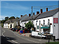
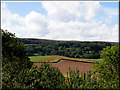
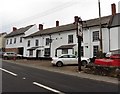
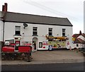
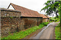

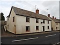

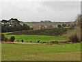
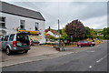

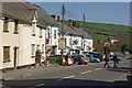
16 photos from this area
Area Information
Key information about the TA5 1EA including its size, population, and administrative classification.
- Area Type
- Postcode
- Area Size
- 17.2 hectares
- Population
- 2145
- Population Density
- 42 people/km²
House Prices in TA5 1EA
15
Properties
£279,167
Average Sold Price
£120,000
Lowest Price
£450,000
Highest Price
Showing 15 properties
| Address | Type | Beds | Baths | Last Sale Price | Last Sale Date | |
|---|---|---|---|---|---|---|
| Midways, Main Road, Kilve, Nether Stowey, TA5 1EA | house | 3 | 1 | £300,000 | Sep 2021 | |
| 2, Kilve Court Cottages, Main Road, Kilve, Nether Stowey, TA5 1EA | Terraced | 3 | 2 | £272,000 | Feb 2021 | |
| Tudor Cottage, Main Road, Kilve, Nether Stowey, TA5 1EA | Detached | 3 | 2 | £450,000 | Jul 2016 | |
| Pincop, Main Road, Kilve, Nether Stowey, TA5 1EA | Detached | - | - | £430,000 | Sep 2009 | |
| The Old Post Office, Main Road, Kilve, Nether Stowey, TA5 1EA | Detached | 5 | - | £415,000 | Jul 2008 | |
| Jays Cottage, Main Road, Kilve, Nether Stowey, TA5 1EA | Semi-detached | 2 | - | £140,000 | May 2008 | |
| The Old Bakery, Main Road, Kilve, Nether Stowey, TA5 1EA | Semi-detached | - | - | £127,500 | Jan 2008 | |
| 3, Kilve Court Cottages, Main Road, Kilve, Nether Stowey, TA5 1EA | Terraced | - | - | £258,000 | Mar 2007 | |
| Grantchester, Main Road, Kilve, Nether Stowey, TA5 1EA | Detached | - | - | £120,000 | Jun 2006 | |
| 1, Fossil Cottage, Kilve Court Cottages, Main Road, Kilve, Nether Stowey, TA5 1EA | Semi-detached | 3 | 1 | - | - |
Page 1 of 2
Energy Efficiency in TA5 1EA
Amenities
Schools
| Rank | School | Type | Entry gender | Ages |
|---|
Explore more schools in this area
Go to Schools tabDemographics
Household Size
Two person
most common
Accommodation Type
Houses
most common
Tenure
68
majority
Ethnic Group
White
most common
Religion
N/A
most common
Household Composition
N/A
most common
Age
47
median
Adults (30-64 years)
most common
Household Deprivation
N/A
with no deprivation
NS-SEC
31
in Lower managerial occupations
Explore more demographic insights in this area
Go to Demographics tabPlanning
Planning Constraints
- Flood RiskPremium
- Ramsar Wetland SitesPremium
- Area of Outstanding Natural BeautyPremium
- Protected Nature ReservePremium
- Protected WoodlandPremium