Area Overview for TA4 4LB
Photos of TA4 4LB
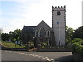
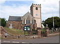

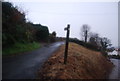


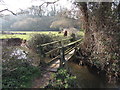
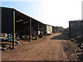
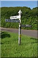
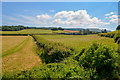
34 photos from this area
Area Information
Key information about the TA4 4LB including its size, population, and administrative classification.
- Area Type
- Postcode
- Area Size
- 8846 m²
- Population
- 1081
- Population Density
- 40 people/km²
House Prices in TA4 4LB
10
Properties
£266,500
Average Sold Price
£119,000
Lowest Price
£365,000
Highest Price
Showing 10 properties
| Address | Type | Beds | Baths | Last Sale Price | Last Sale Date | |
|---|---|---|---|---|---|---|
| Compton, Croft Meadow, Sampford Brett, Williton, TA4 4LB | Bungalow | 3 | 2 | £355,000 | Dec 2024 | |
| The Nook, Croft Meadow, Sampford Brett, Williton, TA4 4LB | Bungalow | - | - | £222,000 | Aug 2019 | |
| Orchard Waye, Croft Meadow, Sampford Brett, Williton, TA4 4LB | Detached | 3 | - | £365,000 | Apr 2019 | |
| 20 Croft Meadow, Sampford Brett, Williton, TA4 4LB | Semi-detached | 3 | - | £250,000 | Oct 2016 | |
| Langdale, Main Road, Sampford Brett, Williton, TA4 4LB | Bungalow | 2 | - | £247,000 | Jul 2014 | |
| Apple Acre, Croft Meadow, Sampford Brett, Williton, TA4 4LB | Bungalow | 5 | - | £307,500 | Jun 2014 | |
| 19 Croft Meadow, Sampford Brett, Williton, TA4 4LB | Semi-detached | - | - | £119,000 | Oct 2000 | |
| Redlands, Croft Meadow, Sampford Brett, Williton, TA4 4LB | Detached | 2 | 1 | - | - | |
| Overbridge, Main Road, Sampford Brett, Williton, TA4 4LB | Bungalow | - | - | - | - | |
| The Croft, Croft Meadow, Sampford Brett, Williton, TA4 4LB | house | - | - | - | - |
Energy Efficiency in TA4 4LB
Amenities
Schools
| Rank | School | Type | Entry gender | Ages |
|---|
Explore more schools in this area
Go to Schools tabDemographics
Household Size
Two person
most common
Accommodation Type
Houses
most common
Tenure
83
majority
Ethnic Group
White
most common
Religion
N/A
most common
Household Composition
N/A
most common
Age
47
median
Elderly (65+ years)
most common
Household Deprivation
N/A
with no deprivation
NS-SEC
40
in Lower managerial occupations
Explore more demographic insights in this area
Go to Demographics tabPlanning
Planning Constraints
- Flood RiskPremium
- Ramsar Wetland SitesPremium
- Area of Outstanding Natural BeautyPremium
- Protected Nature ReservePremium
- Protected WoodlandPremium