Area Overview for TA4 4AA
Photos of TA4 4AA
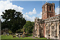
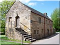
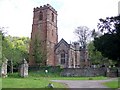
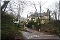
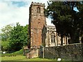
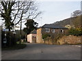
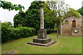
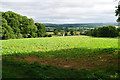
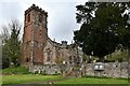


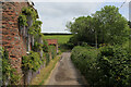
53 photos from this area
Area Information
Key information about the TA4 4AA including its size, population, and administrative classification.
- Area Type
- Postcode
- Area Size
- 52.1 hectares
- Population
- 2044
- Population Density
- 20 people/km²
House Prices in TA4 4AA
24
Properties
£483,729
Average Sold Price
£225,000
Lowest Price
£795,000
Highest Price
Showing 24 properties
| Address | Type | Beds | Baths | Last Sale Price | Last Sale Date | |
|---|---|---|---|---|---|---|
| Townend Cottage, Mark Herniman Hill, Crowcombe, Bishops Lydeard, TA4 4AA | house | 4 | 2 | £635,000 | Jan 2023 | |
| Smithy Cottage, Mark Herniman Hill, Crowcombe, Bishops Lydeard, TA4 4AA | house | - | - | £375,000 | Mar 2019 | |
| Shute Cottage, Mark Herniman Hill, Crowcombe, Bishops Lydeard, TA4 4AA | Character Property | 2 | 1 | £370,000 | Nov 2017 | |
| Timewell, Mark Herniman Hill, Crowcombe, Bishops Lydeard, TA4 4AA | Semi-detached | 4 | 1 | £400,000 | Dec 2016 | |
| Yard End, Mark Herniman Hill, Crowcombe, Bishops Lydeard, TA4 4AA | house | 3 | - | £300,000 | Dec 2016 | |
| The Paddocks, Mark Herniman Hill, Crowcombe, Bishops Lydeard, TA4 4AA | house | - | - | £685,000 | Aug 2016 | |
| Gratton House, Mark Herniman Hill, Crowcombe, Bishops Lydeard, TA4 4AA | house | - | - | £635,000 | Dec 2015 | |
| Timbers, Mark Herniman Hill, Crowcombe, Bishops Lydeard, TA4 4AA | Detached | 4 | 2 | £394,750 | Jun 2015 | |
| Glebe House, Mark Herniman Hill, Crowcombe, Bishops Lydeard, TA4 4AA | house | - | - | £600,000 | Oct 2011 | |
| Combe Cottage, Mark Herniman Hill, Crowcombe, Bishops Lydeard, TA4 4AA | house | - | - | £390,000 | Sep 2010 |
Page 1 of 3
Energy Efficiency in TA4 4AA
Amenities
Schools
| Rank | School | Type | Entry gender | Ages |
|---|
Explore more schools in this area
Go to Schools tabDemographics
Household Size
Two person
most common
Accommodation Type
Houses
most common
Tenure
75
majority
Ethnic Group
White
most common
Religion
N/A
most common
Household Composition
N/A
most common
Age
47
median
Adults (30-64 years)
most common
Household Deprivation
N/A
with no deprivation
NS-SEC
37
in Lower managerial occupations
Explore more demographic insights in this area
Go to Demographics tabPlanning
Planning Constraints
- Flood RiskPremium
- Ramsar Wetland SitesPremium
- Area of Outstanding Natural BeautyPremium
- Protected Nature ReservePremium
- Protected WoodlandPremium