Area Overview for TA3 7LN
Photos of TA3 7LN
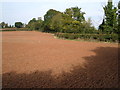

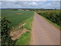
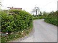
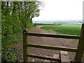
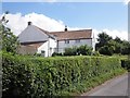

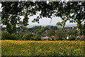
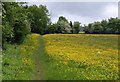

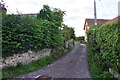
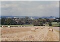
17 photos from this area
Area Information
Key information about the TA3 7LN including its size, population, and administrative classification.
- Area Type
- Postcode
- Area Size
- 72.9 hectares
- Population
- 2088
- Population Density
- 202 people/km²
House Prices in TA3 7LN
14
Properties
£561,250
Average Sold Price
£229,000
Lowest Price
£985,000
Highest Price
Showing 14 properties
| Address | Type | Beds | Baths | Last Sale Price | Last Sale Date | |
|---|---|---|---|---|---|---|
| Kibbear Mead, Kibbear Lane, Trull, Taunton, TA3 7LN | Detached | 4 | 3 | £985,000 | May 2018 | |
| Little Kibbear, Kibbear Lane, Trull, Taunton, TA3 7LN | Detached | 8 | 4 | £895,000 | Feb 2017 | |
| 2, Kibbear Cottages, Kibbear Lane, Trull, Taunton, TA3 7LN | house | - | - | £402,500 | Feb 2017 | |
| Kibbear Cottage, Kibbear Lane, Trull, Taunton, TA3 7LN | Detached | 4 | 2 | £575,000 | Nov 2016 | |
| 1, Kibbear Cottages, Kibbear Lane, Trull, Taunton, TA3 7LN | Detached | - | - | £229,000 | Sep 2006 | |
| Kibbear Barton, Kibbear Lane, Trull, Taunton, TA3 7LN | Bungalow | 4 | - | £281,000 | Mar 2002 | |
| The Bungalow, Kibbear House, Kibbear Lane, Trull, Taunton, TA3 7LN | Bungalow | 2 | 1 | - | - | |
| The Flat, Kibbear Farm, Kibbear Lane, Trull, Taunton, TA3 7LN | Flat | - | - | - | - | |
| Lower Kibbear Farm, Kibbear Lane, Trull, Taunton, TA3 7LN | Detached | - | - | - | - | |
| Annexe At, Little Kibbear, Kibbear Lane, Trull, Taunton, TA3 7LN | Detached | - | - | - | - |
Page 1 of 2
Energy Efficiency in TA3 7LN
Amenities
Schools
| Rank | School | Type | Entry gender | Ages |
|---|
Explore more schools in this area
Go to Schools tabDemographics
Household Size
Two person
most common
Accommodation Type
Houses
most common
Tenure
84
majority
Ethnic Group
White
most common
Religion
N/A
most common
Household Composition
N/A
most common
Age
47
median
Adults (30-64 years)
most common
Household Deprivation
N/A
with no deprivation
NS-SEC
50
in Lower managerial occupations
Explore more demographic insights in this area
Go to Demographics tabPlanning
Planning Constraints
- Flood RiskPremium
- Ramsar Wetland SitesPremium
- Area of Outstanding Natural BeautyPremium
- Protected Nature ReservePremium
- Protected WoodlandPremium